 Islanda
|
Pagine 1
|


My magic Iceland
Stato: ICELAND (IS)
Journey through Iceland. Km 3832
Text by Anna Marchisio
Photo of Mark Giovo - Anna Marchisio
While I was preparing to complete the pages of my diary, the country of which I write has to go through a serious economic crisis, not that the rest of the world is much better, but for a country which is not usually occupy the first pages of this chronicle world is certainly not what the locals would have wished to speak a little 'if and to their own country.
Like all the countries I have visited Iceland has found his little spot in my heart and perhaps because we have been, because I have traveled the streets, walked its paths, met its people, or because they have been some time part of this world do not come back once I am interested in what happens.
And since we are about the economy now face this issue ... will be that prices in Italy rose dramatically but to me that shopping in Iceland does not cost more than in Italy, and even gasoline ... Of course if we talk about Hotel and restaurant prices are a little 'are so salty, but also in Italy, make no mistake that cost us much less, now all the prices have risen as the dough for pizza: doubling in just their value!
Iceland is not yet part of the European Union and its currency is the Icelandic krona. With the crisis this year and the effect of inflation and various write-downs, we understand a lot of high finance so I stick to the facts, I said it was mostly quite devalued against the euro over the past two years and it is precisely for this that the prices we seemed so exaggerated as they were years ago. Currently the government is thinking seriously of joining the European Union to go so to the Euro.
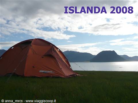
Surely someone will object that for us to Iceland was not expensive because we have stayed in camp and we have brought the fornellino from home. Claim that most lawful ... but I can say that nothing like our tent has granted us the freedom to decide each day where to go, what to do and above all enabled us to stay in close contact with this extraordinary nature. Oh dear .. When the white partridges began their concert to the four in the morning we would have gladly had silenced but still so good to hear you sing a few steps from us.
The weather in Iceland is not an ally of the campers. Despite all the pessimistic forecasts of friends and relatives we have not taken all the rain we had expected. It rained when we arrived and it rained when we went there, but during our stay we had not come to terms with the rain. We still have to reckon with the strong wind and low temperatures. Our tent has performed the most of his task and even if sometimes the assembly and disassembly has been made very difficult by strong gusts of wind after all this, we fared very well and we can recommend this solution to all those who do not have trouble adapting to the climate and to address some minor problems. Eh si .. is not like camping in the Riviera!
The Icelandic climate is temperate, we are sure it is cold in the north, but the current of the Gulf is helping to keep this temperate climate. The current of the Gulf, for those who do not know, is a warm current that helps in these latitudes, the cold currents that arrive from Greenland and art.
Returning to the camp ... fornellino was another apt choice! Also because the camps are often in no more absolute and without 'food service' to follow you risk running out of dinner and breakfast! For gas, there are marketing types and well-known brands including one that served us. You can buy from the petrol Oz. If you are lucky in the camp of Keflavik or Garður or perhaps one of Reykjavik are those made by travelers departing that are left in the spaces provided for use by those in need. So nothing goes to waste!
As a service we pass by with essential camping toilets and sinks to those supplied with most showers, washing machines and some even with the kitchen. Generally, with some exceptions, have all the hot water and heating on! In some cases the shower is included in the cost of the camp, in other works on coins, in others it is paid to the caretaker.
Most often there is no guardian to protect, one arrives you choose a nice piece of lawn and system. We must tell the lawns are perfect for planting a tent, they are all beautiful all'inglese shares. Usually towards evening the keeper does his tour and comes to claim the fee and although it may seem odd or out of place if it comes with a nice pos with a wireless connection that accepts the credit card. And say that I live in a country of seven thousand inhabitants and the credit card I use it only to the supermarket!
The roads, no tracks, are very beautiful, both those that are not paved roads. You can safely go with car standard without any difficulty. The slopes are slightly rough and there are no bridges to cross rivers, so it makes a very robust and high ground clearance. By this time we rented a car, it was our intention to begin to learn about this country from the internal to the tracks there will be time next time, though .... something we have already tasted this time!
Say that the Icelanders? Mmmmhhhhhh .... I found them not particularly sociable, is the isolation, the different culture, who knows ... but in return I found them very noisy. Camping just put together some family and the noise is guaranteed!
It should however be said that almost all speak good English so communicating is not difficult, but I think that reflects exactly what I've read that in Iceland there is a high cultural level and there is no illiteracy.
But why move to Italy with public transportation is always a tragedy? We had no desire to leave the car at the airport all this time and we did not want even my dad who accompanied us since Malpensa, compared to home, is not exactly what you say 'around the corner'. By controlling all the good times of the buses I see that with a combination of bus we arrive at Malpensa with a large, rather broad advance on the flight, so we decide to try. We have a friend who is fixed with the use of public transport for a time to adhere to its principles. I must also admit that for me I do the commute all year to pass on the first day of vacation waiting bus, stamped tickets, check times is not just a great way to detach from the daily grind cross! However apart from the irony we did to arrive at the airport! It 'been a long but we did!
Ironically, the flight to Reykjavik scheduled for 23:30 and was late!
Landed in Reykjavik rather sleepy, there was someone who thought the aircraft had to make good conversation for the entire time, and be a little 'quiet time view?
Collected our luggage we go to pick up our car we had booked from Italy. Well ... our experience with public transport was limited to Italy! Here we want to be independent, especially as we run and it seems like without the constraints of time and time!
However it must be said that in Iceland there is no rail network and the only public transport is the bus connecting the main village of the country.
That emerge from the four in the morning (local time), is dark and raining, we do? Go and find a campsite and pitch your tent is not an issue, go to find a hotel? But who wants to get at this time to look over everything to sleep a couple of hours! Sistema our luggage in the car, we accommodated for benin seats and good night .. when will we review daily. At about seven we wake up from pick-up in the airport, a plane took off! Time is now somewhat uncertain and I say to myself ... "I'm miiii beautiful sky of Iceland with all these clouds, so who knows if it will be for the entire trip!"
The airport is Keflavik, in the Reykjanes peninsula where we decide to start our visit.
When supplied with a little 'food, are found almost everywhere from supermarkets, and of the precious gas cylinder we head immediately to Garðskagi. This is a beautiful promontory beaten by strong winds considered a haven for birdwatchers. There are two lighthouses and a free campsite. E 'a quiet, silent, full of scenic charm. The strong winds that cause a disruption to the hair, the cold that enters the blood, the smell of the sea surround this place a special charm of a unique and indescribable poetry, has no chance that I decided to come here to spend our last night in Iceland .
We continue our journey along this peninsula slowly accustomed to the lonely and desolate landscapes. The traffic is almost nonexistent. We stop at several points, to observe a bird settled on some rocks, to scan the horizon of the endless fields of lava that date back to the thirteenth century, asking how can a desolation so vast, so endless.
We stop in the area of Valahnùkur, where there are the ruins of the oldest lighthouse of Iceland and the surrounding cliffs can be seen so many birds. Walk on the bridge between the two continents, and is where the tectonic plates of the American continent is meeting with the European continent, there is also a place where the two plates are moving away instead, but that's another post, a 'another story.
We shall also in the area of the lagoon blue, but we pause only to observe them against the blue water flowing through the lava fields to the blacks. A particular contrast, only one. The Blue Lagoon is one of the major attractions of the country, a place where all come to spend a few hours, is a spring fed by natural hot springs that emerge at 38 °. The effect of a bath in this water on your skin is like that of a scrub while your hair is not really a big deal!
Despite the bad start to the day time you have got. The gray sky gave way to a beautiful blue sky. Iceland will learn that the weather is very variable and in nothing is changed from good weather to bad weather and vice versa. The wind is a constant almost always present. An Icelandic says that if you do not like the time just wait a moment and time will be even worse. So a wave of optimism weather!
In the afternoon we visit the thermal springs of Seltùn, there are a series of walkways that allow you to walk among fragrant fumaroles at all, in pools of boiling mud and sulphated. The colors are impressive for such land, the nuances of the layers of minerals to give our eyes. The same pleasure I do not feel the smell! That stinks of rotten eggs!
For the night we stop in Camp Hveragerði, a quiet town. But I must say that in Iceland they are all quiet towns and villages sometimes struck me as deserts, buildings, solitary. Will be for the adverse weather conditions but the streets of villages I have always found with no life or at least what is life for us, not a person on the street, not a child who was playing in the street, an elderly couple sitting chatting front of a house. Nothing .. even dogs and cats that sleep in the garden. Doors and windows closed and always the feeling that the inhabitants of these places to live their lives mostly inside. Like him wrong? If this is the climate in the summer let alone winter!
The area around Hveragerði is rich in thermal springs and pools, even the nearby golf course here and enjoy some steam out of the ground. I must admit that after the pools golf courses are the second favorite activity of Icelandic. I have never seen so many, certainly the green they have not made it difficult for construction and maintenance of these places. The swimming pool, can I open a parenthesis beautiful. Blessed are they? Eh already .. here we have a pool all, I dare not even think, while their inhabitants have a country and most often have the pool and discovered for the summer and swimming pools!
A little out of Hveragerði is a beautiful valley with a river geothermal heat, where you can swim.
Assemble the tent in a corner of the camp, there are many other campers, but despite this is a fairly quiet place. The sky is clear and the sun shines in the sky late at night, set shortly after the 22 and the temperatures are pleasant so that enjoy our first dinner sitting on the lawn in front of our tent! You say that and never will be .. Will be that of dinners we have had just a few!
The song of birds accompanying our first evening in this beautiful country and the light that seems to not go more volersene gives us the feeling that you have very long days!
We wake up very early, we have not yet accustomed to the many hours of daylight available to us.
Today we a piece of what is called the Golden Circle: Gullfoss, Geyser and Þingvellir. Three are among the places that attract the largest number of tourists, this is a great waterfall, Geyser of par and the most important historical site in the country and place to testify to the special division of the plaque removal of the two continents, Europe and the the American, who meet here. We will visit the first two, leaving history aside, but only for the time being.
Geyser to arrive before the hordes of tourists, this is one of the advantages to be Early Bird. With all quiet walk in the midst of several small and different colored sergeants bubbling pools. In the midst of all this Strokkur the geyser, which erupts every 6 minutes by issuing a gush top 15 to 30 meters, and the par Geyser that gave its name to the phenomenon. Unfortunately geyser erupts once a day and do not know when. In the past, tourists had to tease the bad habit of throwing stones inside with the result that throws a stone today and tomorrow buttane high and Geyser was blocked. All this happened at around the fifties, before then issued the splashing of water that reached up to 80 meters. In 2000, an earthquake, so to speak, moved a little 'things and today it is said that Geyser erupts a few times a day. We we were not lucky and Geysir we have always seen with his typically dormant, while Strokkur gave us some great memories.
Let us head to Geysir Gullfoss. Foss is the word that means waterfall in Icelandic, we have not learned much of this language, but something in the end we have also treated us. It 'really a tricky language, is incomprehensible to hear you speak and the words, so often are unpronounceable. In their alphabet letters are many details that arise dall'alfabeto Runic. Icelanders, however, are proud of their language, unlike other Germanic languages belonging to the Scandinavian strain, has not changed over time, keeping the sounds and letters so that the ancient Icelanders today read the sagas written quietly centuries ago because the language has remained virtually unchanged.
One thing that intrigued me was reading how names are born. It is not like us to the surname of the father who has been handed down from parent to child but in Iceland the last name of a person is the name of the father to which is added the suffix son when the baby is male or goods if the newborn is female. So as a guy say to his son, daughter of guy ... This way of giving names belong to the culture of the country and also explains why the names in Iceland have little importance and the Icelanders have a habit called directly by name! Oh well ... I always hated calling people with the surname and call me with it, I feel so impersonal! This curious aspect of Icelandic culture, I was fascinated and curious, and I enjoyed reading the names and surnames on pamphlets and newspapers and then establishing the sex of the person carrying the name.
But back to our journey ...
Gullfoss waterfall is the highest in Iceland and also one of the most visited by tourists. It is very suggestive because the impetuosity of flows with two very spectacular double jump of approximately 32 meters, all within a canyon. Its waters are dark, the color of the water coming from the glaciers and it loses a little 'poetry.
We study the map carefully, because the runway there stuzzica F35. We do not have half of a 4x4, but from the bottom of the dirt road is not particularly difficult. There are rivers to ford, or the like. During the summer it is even used by buses going north, a sort of shortcut.
However after some 'second thoughts to decide to keep the route that we set and then continue eastward along the coast.
A stroll 'through the streets of this area of the country with the intention to find a point where you can admire the volcano Hekla in all its magnificence. While we turn we come across a small waterfall, stuck in a gear rocks. Very suggestive, we do not know if you have a name or is one of the many waterfalls that enrich this country.
The meadows in Iceland are mostly used for grazing sheep and horses. The Icelandic horse is characterized by short stature, with a very docile and patient, and is known for its great strength and stamina.
In the harsh climate of the agriculture is thriving in some areas where the cultivation takes place in heated greenhouses. The rest of the field is cut to produce hay for livestock forage during the cold season. Images of endless green fields scattered by the whiteness of white sheep to pasture or the huge bales of hay in nylon incellofanate white, and maybe an island farm with the church and a small cemetery across this vastness is an icon, a feature of this landscape that I like and remember that I liked to stay to observe.
In September, the farmers gather all the sheep around the country before the arrival of winter. This particular event is enriched with local folklore, songs and entertainment that will enliven the collection of animals to the pens where they will be grouped together. A moment of aggregation of communities which marks the transition since the winter.
Returning to the volcano Hekla, is perhaps the most famous of Iceland and is still active even though its summit is often covered by snow all year round. E '1491 meters high and you can reach the summit on foot. The paths that lead all'Hekla start at a track is not suitable for normal means.
Even if we started walking early this morning, the time has passed and the evening is approaching. We decide to stop in one of the camps, let me tell you, more suggestive of Iceland: Hamragarðar. The camp is located right next to two spectacular waterfalls, one is even behind the campsite. Assemble the tent in a clearing behind us where we can see hidden among the cliffs Gljùfuràrfoss, a picturesque waterfall that plunges into a canyon hidden. To see it in all its uniqueness must remove their shoes and step through the stream that comes out of the gorge where the falls cascade. While little is far more admire the Seljalandsofoss where waters fall from a steep rocky slope in a very deep lake. A path, of course wet, allow to go behind the waterfall and watch the water fall so impetuous.
The campground is quiet, there are also showers, which operate in coins and a kitchen. The land is owned by the nearby farm and towards the hour of dinner is the guardian of his tour in tent tent to collect the cost of accommodation.
If we look behind us we see and feel the momentum of the waterfalls flow, in retrospect can we look forward we see the vastness of this land el'immensità lonely moors of these almost deserted. There are no lights of any city in the distance, the noise of civilization on the move, there is only silence and the vastness of this land austere and wild.
Until now, two days, the weather was on our side, allowing a clear day and just floated for a while 'of days we will know the other face of Iceland, that of strong winds and incessant, from the cold and pungent that enters the bone and the gray and gloomy skies that recall the sad days of autumn rain. So pulling off the gloves and cap it will!
See all our aspirations in terms of walking and hiking when the wind is calmed. The days nebulae and the cold wind does not help us to make sure the backpack on your shoulder and walk towards unknown destinations.
Resumed the number one way eastwards we stop to admire the waterfall Skògafoss. This is a beautiful waterfall with a jump of about 62 meters from a rocky slope. Several sheep scattered here and there on the slopes of the mountain from which falls the waterfall makes the scenery very particular. A short trail climbs far above the waterfall allowing you to admire the leap from the water. It is said that a certain þrasi have hidden behind the waterfall, a chest of gold and someone says that sometimes you can see the glittering of gold behind the water that falls. Mah ....
Our next stop, and near one of the most easily accessible glaciers of Iceland: the Sòlheimajökull that expands from Myrdalsjökull. Leaving the main road for a runway of about 5 km you reach a small parking area and stroll with a microscope before you arrive to the glacier. The moraine of the glacier has not anything spectacular or idyllic, mixing ice, earth and sand and we must be careful where you walk to avoid slipping. In any case, a beautiful stroll alongside the moraine of the glacier we will also give us.
Our next stop is around Dyrholaey, a majestic stone arch. The area around all'arco is a nature reserve and there are many Puffins to sea that come and go by sea to their nests. These adorable birds by looking a little 'sad fact nest on the mainland in holes dug in the ground. Come flying, landing and then with its beak full of fish they look around before intrufolarsi in their lair.
This is an area of great charm, are all these beaches and the black rocks with vertical walls where the birds nest, this plain strange, which is not a flat and then the glaciers, all very special and charming.
Then we cross a broad area, virtually deserted, Skeiðaràrasandur, the land stems from debris of the glaciers, which are sent up from the downstream rivers. In this arid land and desert, created only by the debris and sandy clay tantissimi live birds. Features are the beaches of black sand. This particular environment in the Icelandic language is called Sandur, but that deadline has now joined the international vocabulary to describe these particular areas, these particular lands.
Among the birds that we could see there is the stercoraro greater. Described by a bird guide as anything but beautiful and a bit too aggressive. Mah. us, we stopped along a track for lunch, we took two steps and we saw two examples of stercorari, and apart from their eyes a little 'harsh and aggressive were not at all dangerous or obnoxious. There must also be said that they had no reason!
Our next stop is the National Park Skaftafell. This is the largest national park, by extension, of Europe. Within its borders there are spectacular mountain peaks and glaciers including a portion of the largest ice cap in the world: the Vatnajökull. From this enormous glacier leaving many languages including frozen within the boundaries of the park. This huge glacier and this extraordinary park also accommodate the primacy of its borders, the highest mountain of Iceland the Hvannadalshnùkur, well 2119 meters high. You can access his sommittà with an excursion organized by the guide that in addition to accompanying clients on the summit will also provide all the equipment necessary for the ascent to the summit. The Hvannadalshnùkur is part of a huge crater about 5 km wide. This is dell'Oræfajökull, the largest active volcano Mount Etna after. Some leadership we have too!
As guides and pamphlets heralded this park is a much visited destination in the summer, the visitor center is crowded with people and parking in front of the tourists who come and go are so many.
The park was established in 1967 and its original boundaries were much smaller, is currently being discussed the possibility of further enlarging its borders to form a single, huge national park, together with the National Park Jökulsàrgljùfur. If seen on a map the two parks are not so close, and this new park that would be found would cover 40% of the territory of Iceland, in short, a huge national park.
The origin of the name is more curious, given that the name of an old farm located at the foot of the hills. As a result of the movement of sands of the glacier fields were invaded by glacial sands and the farm was moved above the sandur somewhere more appropriate to call the note Hèrað Milli Sandur oxy land between the sands. But it was not destiny, and with the 1362 eruption dl all the farms were destroyed and the area was renamed Oræfi meaning 'land desolate'. Our farm, which was in fact the name of the park, was then built on its original site.
There are some trails in the park by making it possible to go make nice excursions to discover the park and its magnificent ecosystem.
Place the tent in one of the meadows of the camp. There are lots of tents, singles, groups, large groups, then there really so many people. The camp is not bad, maybe a little 'too crowded. Spaces for the tents, there are many and there is no risk of being stuck or all shriveled like sardines but the only sore point is the insufficient number of services ... not only in kilometers code to make the shower, to make their needs or just wash your teeth but also to wash the dishes. So any service in most countries would benefit all.
In this fascinating place we prepare the finest scrambled eggs with tomatoes. So the hole is defending well and we can safely do without indigestion's up of pasta and risotto ready. For the record, I must admit that my maritini was literally in love with a sort of spaghetti bolognese in the envelope that we found in supermarkets Icelandic. According to him all the best pasta ready to sell to us. He is almost unbelievable but before leaving he made a beautiful fitted with these spaghetti for his future camps in the mountains!
We have paid a single night in this camp because we wanted a little 'see how it evolved, the time and decide accordingly whether to stop a few days or continue our journey. This morning, the sky is overcast and there is also a good strong wind. We wrap for Benin and backpackers we are along one of the many trails in this park. Our intention is to make a passing bell'anello that all the ridge can see the valley of Morsàndalur and the language of the glacier Skaftafellsjökull, with a small deviation can be up to the summit of Mount Kristìnartindar (m. 1126). The first part of the path is the same that leads to a cascading waterfall framed Svartifoss between columns of black basalt, the volcanic rocks are solidifying that took the form of long hexagonal columns. Svartifoss means black waterfall. It 'too early and the hordes of tourists have yet to arrive so we can enjoy this waterfall in peace. He looks a little 'dark, detail. The trail from the campground to the waterfall, return between approximately one and a half, but we go ahead, cross the stream that comes from the waterfall and go up the path towards Sjònarsker, a plate of guidance as always Marco studied carefully . The wind is strong, we try to go a little 'over the plate along the path we have set ourselves to go but a little' for the very strong wind, for the gray clouds and low fog we wonder what is the point further. See the map and decide to fall back on another trail that goes back, apparently in an area less exposed to winds, a tongue of the glacier Skaftafellsjökull. The wind was not just on this track but this time not abandoning the idea and make our whole tour. The view from the top of the glacier is very special, the fog gives it a low air a little 'dark, gloomy, with the only sin was another music.
Besides the scenery is worth a visit the farm in peat from the roof of Sel
Returning to camp we continue our journey in an easterly direction towards Höfn. The landscapes that can be admired along the journey are very beautiful and evocative, and perhaps a little 'for the day or the dark gray clouds, but this provides a climate that is not so melancholy that makes it very evocative landscapes that our eyes see scroll around us.
Another fascinating place where you will find many tourists is the lagoon where Jökulsàrlòn blue iceberg floating in the waters of the lagoon to reach the sea. The iceberg breaks off from one of the many languages of Vatnajökull and slowly reach the sea, some iceberg also employ the years to come out of this lagoon of some 17 square kilometers. Among the icebergs that float you can see the seals that swim in these waters calm and when the sun can be seen asleep on the iceberg to enjoy the rays of the sun. This second option because of the cloudy sky was not part of our visit! This lagoon, it must be said, there is only 75 years and feel that is growing so dizzy .. ahi ahi ahi ...
For those who want to wander into the lagoon you can do so by joining one of the excursions organized by amphibians, engage in swimming, as the seals, is a bit unwise, the water could be just a bit cooler!
As we walk along the lagoon can see many white-tailed terns also called sea swallows. These small birds are very beautiful and very elegant, vaulting into the sky with an innate grace, yet they are very Scassa XXXX. In addition to adults, there are also many children who have already involuti (left the nest), adults bring the food and warn of danger to their children begin their war to expel the poor tourists capitato mal. Start volarti around on their heads beaten in by issuing a strident toward. Let it go because they do not let so much!
We decided to stop and Höfn for the night. This is a quiet village, I would say one of the many citizens of Iceland sleepy that we have seen. He has a fantastic location along the bay, we walk a little 'to the streets to reach a promontory with a beautiful view. The camp is very nice but the wind is really strong so we decide to continue in the hope of finding a campsite a little 'less exposed to the cold wind Icelandic.
So we stop at the campsite Stafafell a solitary farm with a few other travelers. This is also Iceland, the absolute silence, the hiss of the fierce wind around nothingness and silence with which the night follows the day slowly.
The wind this morning is still stronger and dismantle the tent is not exactly been a walk but for now it is gone. Oddio without noticing that the cloth under the tent, we took the flight, but fortunately two French children if they are noticed immediately and went to retrieve it. If it was not for them was lost! Before finally leaving the campsite Stafafell we stop at the nearby farm to pay for our overnight stay. We thought that the factor, as predente evening, came to collect the night but since I do not seen us make a jump from him before you walk. A chronicle of having accurate bathrooms, even if a little 'Spartans are equipped with everything you need, there is even a shower (included in price), a washing machine and un'asciugatrice.
Factor of the dog barking but welcomes us like all small dogs are much ado about nothing, we play the bell and the factor, or his, is to open. E 'un omonia certainly a descendant of the Vikings, with their hair arruffati and do a bit surly, as befits a factor of an area so isolated.
Leaving the farm, take the road towards the east, cross the zone of Lon, which literally means the lagoon, stopping several times to observe and photograph this vast expanse of swans. On this lagoon already a huge nest colony of swans, I have to say that he had never seen so many swans all at once. E 'uno spettacolo unico. The lagoon is huge, and looking at the horizon you will see all these white dots that paddle in the tranquil lagoon. Awesome!
Then we continue our way towards the eastern fjords. Although the day is gray and gloomy landscapes that are rich in cross charm. As we approach to this area of the broad plains and lagoons given way to steep mountains dropping to the sea, on cliffs and severe ago to see the way scroll, on the coast overlooking the sea where the waves hurl against rocks.
Thus, we arrive at Djùpivogur, a small village of the eastern fjords with its colorful wooden houses. The port of this village is the oldest port in the whole area of fjords and from here boats depart for the island of Papey, or island of the monks, because a time before the arrival of Scandinavian settlers was inhabited by a group of friars hermits. Today this island is inhabited only by seabirds and seals. If the weather was beautiful, the clear skies and calm seas have certainly made a scappatine on this but the strong wind, the sky gray and especially the sea very rough not give us any chance.
We so this one road that goes through the fjords and dips in this area with almost arrogance. The number one way it must be said, is also the only road that runs across the perimeter of the island, is the prevalence asphalt.
For lunch we go along a road that goes back a valley that overlooks the long Berufjörður, a mountain near the sea, are the impressive cliffs that characterize these fjords these valleys. Walk a few kilometers of this road, which enters the valley in order to enjoy the landscape and to be able to admire the view of the fjord from the top of this road.
After lunch take the main road, the one direction Breiðdalsvìk. But at this point I must say that although I wanted to travel the road that runs along the fjords Marco insists on changing some 'landscape and convince me to leave the road that runs along the eastern fjords Breiðdalur to go in a beautiful Alpine valley that leads to a step from where you back down to Egilstaðir. The road is unpaved and the few sheep that graze not meet other car or other passengers.
In fact it is one of those typical alpine road bends to go up that allows you to quickly share, and above all to enjoy a panorama of the valley very beautiful. Pointing to the hill in a small pond and a campfire.
Descend so Egilsstaðir Lagarfjot along the lake which is said to be the home of a monster like that of Lokness. But as the days are always long we decide to pursue and achieve Borgafjörður Eystri, the village further north of the eastern fjords.
The way Egilsstaðir is long (about 70 kilometers) mostly unpaved. We cross wide meadows to wander the mountains for a step up from where you back down the valley to the fjord along the coast severely. These roads in the series, better not leave the road if you do not want to give up finish, are impressive!
The village of Borgafjörður Eystri is located in an enchanting location in the area there are many excursions to the nearby mountains of Dyrfjöll but it is really far away from the rest of the world. Live permanently in the area less than 150 people. Dyrfjöll is one of the most striking mountain in Iceland full of glacial lakes and beautiful landscapes.
The camp is in the center of the country, services are very beautiful and cared for, there is even the kitchen. There are several tents but you can not just say that it is crowded. After dinner we make two passes through the village, for the fog is low to the climate but by the end of November brings a melancholy ... Iceland is a beautiful but sometimes I wonder how one would live in these villages, we used to heat of the sun, the light blue of the heavens, who knows ..
Icelanders celebrate April 24 on the first day of summer. The end of winter, the long Arctic night, is accompanied by celebrations, songs, and performances on the streets, is a true national holiday! And since we are on holidays June 17 is celebrated independence occurred in 1944 (during World War II were occupied by the British) for those who have the opportunity to assist you there are big celebrations, ceremonies, parades and dancing.
Iceland since 1994 has become a Constitutional Republic. It has a parliamentary system of government where the chief minister and ministers form the government, more or less as it is from us, and they remain in office if they are supported by the majority of the members of Parliament called the Althing. Iceland also has a President of the Republic but remains in office for four years. It's very important to some Vigdís Finnbogadóttir was the first woman president of Iceland and was elected on three occasions. Other than the Ministry of Equal Opportunities!
Another curious thing is that Iceland does not have an army, at least not spend public money on useless armaments different. Iceland is in fact one of the few countries in the world not to have an army, of course there is the police, the coast guard but there are soldiers! In any case, Iceland is part of NATO.
Returning to the Borgafjörður Estri ...
In the center of the town you can admire the house most of Iceland hairy, already a small house covered with red turf. To enjoy the view from the small village go up the hill to Alfaborg (30 m) reached by a short path marked. This hill is also the home of the queen of the elves that we be careful not to disturb, we never know that these are not real like surprise visits.
The next morning, once dismantled the tent, we are going to visit the nearby islet of Hafnarhòlmi connected to the mainland by a causeway. Nest on this island of about 10,000 specimens of sea Puffins! A real paradise for this lovely bird. Access to free and is a system of catwalks and ladders can observe these birds. There are plenty of examples that Puffins come and go by sea to their nests with a beak full of fish. Rest on the grass, you look around and then you fast intrufolano inside their nests.
Rimarrei here all day long, these cute Uccelletti I like to be crazy, but time flies and we must resume our road puffins ... good bye !!!!!
Returning to Egilsstaðir decide to take another scenic road, which leads to another Seyðisfjörður picturesque village of the eastern fjords.
We stop to observe the Gufufoss before reaching the village, the valley of Seyðisfjörður is very steep and that, during the winter is a problem for avalanches that could occur among the more unpleasant it is recalled that in 1996 but did not produce victims and that of 1885 which travolse 24 people. By way of news at the time of this tragic avalanche country there for a little over forty years (1848). During the Second World War the village was used as a military base, in short story to tell this country has a lot!
Today they live permanently in the 750 local people and the economy is mostly just on fish, but also tourism is part of, calling it a port of Seyðisfjörður ferries from Europe for those who decide to travel by sea.
Returning from the village almost on top of the hill we find a group of reindeer grazing quiet, or so it seemed as soon as it is aware of our presence he set quickly. Seem to be puppets with their almost ciondolante proceed.
For the night we stop in the little known campsite þurshofðavìk on the shores of Lake Lagarfljot, we hope that the famous monster decides to take a snack with us this evening. The first sightings of Lagarfjòtsormurinn, his name is all a program but simply means the snake Lagarfljot, goes back to Viking. The most recent sighting dates back to 1987 mah .... In any case this mostriciattolo should not suffer because the cold waters of this lake originates from a glacier.
The camp is beautiful, there's so much space and services are very well kept and cared for.
On the eastern shore of the lake there is a dense thicket of fir and birch trees: the forest Hallormsstaðaskògur widest of Iceland! Who, before leaving I said 'In Iceland there are no trees' was not well informed! They have some of our forests, since their climate is almost arctic, but also birds Icelanders have some trees to land on which to rest or to get a nice cantatina!
We spent a quiet night, the only sounds were the wind and water of the lake moved by the wind, fortunately not the monster it is made live.
The recent controversial construction of the dam on the river Jökulsà à From that gave rise to the reservoir of Hàlslòn has in fact changed the nature of this river reduces, of course, its scope, but has allowed us to visit the vast plateau of Jökulsà From à since the road was all paved. Do not take this road (the 910) to give a peek to this area would be a heresy, but it seems this idea came to us only because we find very few cars.
The landscape is unique dell'altopiano, tundra that we lose sight of the background and watch the glacier of Mount Snaefell with its 1830 meters high, one of the highest peaks of Iceland. We follow a piece of the runway by 910 branches off toward the shelter of Snaefell mountain but we must stop near a ford that we have confidence to pass. Or we decide to climb a nearby mountain to enjoy the view from above. Backpackers we are moving towards the summit of this mountain from where we can admire a breathtaking view over the plateau.
But time is tyrant and after our trip on top of a mountain known we lose in the car.
The next step is the Hengifoss, the third waterfall of Iceland for height. The water falls from a height of 120 meters into a gorge of a deep canyon. It is not just what they say, at your convenience because tourists to go there and admire it needs to be done a little camminatina about an hour (one way) up. Half way you can already see the Lìtlanesfoss, a picturesque waterfall surrounded by spectacular basalt columns.
Recovered in the car along the road we find two reindeer grazing in the meadows.
Our path is now considering taking the road from number one to Egilsstaðir Myvatn where we cross one of the most wild and picturesque in the country which have enabled us to have a taste of what is inside of this extraordinary place.
The weather certainly did its part to make it very charming landscape, in addition to the dark sky and a few signs of rain make us the company rents the winter fog. Cross arid lava fields testify to the hardness of these elements as the force of nature can impose its presence, its will. Meet some cyclist who does not envy at all, the cold, wind and rain is not likely to have some nice features that make cycling in this area. But as we draw near to us Myvtan leave behind this sad time we have met along this path.
Already we have seen and that is a day late to decide to take advantage of all this light and clips to visit the area around the volcano Krafla. When you say you want Krafla shows throughout this particular area, but to be precise it is a volcano about 818 m. It is an interesting area, you can see the smoking crater of the volcano, the puddles and bright turquoise waters of the small lake in the crater of Stora-Viti is possible along the walking trail that runs along the rim of the crater.
To visit the steaming craters is advised to stick to marked paths. There are several alternatives, we can make a full turn or are confined to certain sections. Of course we decide to tour longer.
And in the midst of this demonstration of power by nature, man has thought to take advantage of these items and use all this geothermal energy for electricity generally. The work of the central Krafla, and little original in the choice of the name, was completed in 1978. From this point of view, Iceland can be said successful. All these phenomena are not only fuel geothermal tourism to the country but avoid buying electricity on the right and left as it happens in Italy.
Let these sites along with a few other passengers late and this evening we just linger but not so much the sun sets earlier than two hours.
We reach the Lake Myvatn, the fourth largest lake of Iceland, and the small town of Reykjahlið. There are two camps on the banks of a lake on the hill where you can admire the lake and the vast fields of lava. We choose the latter because it seems less crowded. We asked several times what and how to determine the prices of camping, beautiful places we have found very little cost and camps whose service was certainly not the best at prices higher ... mah ... This is part of that second category!
The beauty of traveling alone with the tent is to change route whenever it is like. We have a single event, the one with the return flight, which unfortunately we can not fail, otherwise we can turn at will, going to go east or west, back towards the south or even to the north. The beauty of not having reservations or static routes is just that. Last night we went to sleep thinking that after a visit to the National Park Jökulsàrgljùfur have taken the road to Lake Myvatn and Husavik from there while in the park once we decide to continue in this park to the north, without turning back. This is what I like of our travels ... the opportunity to change their mind and decide at any time to go and what to do.
But proceed with order. A circular route of 36 km covering the entire lake Myvatn and allows us to tour around. In Lake Myvatn are some 50 islands and islets. There are lots of opportunities for hiking, walking and so on. It 'a strange, special. You can see cracks filled with water, caves and natural arches. There is also an important nesting area protected on the north-western shores of the lake. It is a waterlogged area with swamps, lakes and tundra. We take a trip to see if you spotted something interesting. On a pole a Girifalco you look around, perhaps the search of breakfast. Certainly we have not the patience of a birdwatching enthusiast so after a while 'we abandon this and continue our tour of the area.
We have also seen on a pole along the road a glass, a small falcon that moves his head as if he were listening to the music 'TUNZE TUNZE' with the headset! It's funny!
There are also spas that are placed in the north, the Blue Lagoon of the peninsula of Reykjaness.
Our next stop is at Bjarnarflag, east of Reykahlið still active geothermal area. But just look around to see that the whole valley, the whole area around us is still active, you see a little steam tick 'everywhere.
Per fare un po 'di moto decide to climb up to step Nàmaskarð, where we can see the entire area from above. Then descend by another path that leads us directly into the field of geothermal Hver. The trail is a bit steep and slippery in some places, but nothing that is certainly not be selected as the way downhill after intense rainfall.
Walk like many other tourists between steaming vents, bubbling mud pools and pleasant scent of rotten eggs, then back to our car and head for the National Park Jökulsàrgljùfur passing the bridge Grimsstadir that has nothing special except that it tells that in the house near the bridge there is still the spirit of the dead smuggler. Mica is not dead because they have built the bridge and he has lost his job ferryman, no? The fact is that we pass again on this bridge, we passed yesterday, but not even the ghost of a shadow.
The park Jökulsàrgljùfur protect a narrow gorge about 25 km long carved by the river that flows. The canyon in some off point up to 500 meters deep a hundred was formed as a result of floods caused by volcanic eruptions that occurred under the ice cap, then ice, water and fire have created all this! Iceland is perhaps the best example of how these factors may shape the earth and rocks to create so many wonders of nature. Just look around in this fascinating country to understand what these elements are able to create, to shape.
So much for curiosity in Icelandic canyon is said gljùfu while Jökulsàr is the name of the river that flows in the canyon, by the merger of these two words comes the name of the park.
The park is crossed from north to south by two roads: the 864, not asphalt, but comfortably ahead with a normal car and the track ahead F862 only by 4wd. The two roads run on both sides of the canyon.
The main attractions of this park are the waterfalls and Dettifoss Hafranilsfoss. Dettifoss is without a doubt the attraction of the park for excellence and is not wrong if it defines one of the most spectacular waterfalls of the country. Water, an incredible amount of water falls from a height of only 44 meters but the power of all this water impressed everyone present. Un po 'più a monte a waterfall Selfoss is very wide and picturesque whose rushing waters but only by a height of 11 meters.
Let these two cascades are continuing on the 864 heading north, but did not neglect a visit to the waterfall of Hafragilsfoss. This waterfall is very special because it comes from the volcanic channel that generated them. It is very impressive and worth the visit.
Even the extreme north of the park is not poor in attractions. For Asbyrgi the canyon takes the form of a horseshoe and stretches for the beauty of 3.5 kilometers.
Then the way we think of 85 to have a sorbitol scouring dirt road instead of with our great pleasure to the entire road is paved, so the trip to Husavik is from this point of view very nice. The landscapes we see, rugged cliffs overlooking the sea are truly amazing and once again make us appreciate even more our choice to change the path and even go here. Good choice this time!
Come to Husavik, the capital of whale-watching, towards the hour of dinner. We fitted to the campsite where we are also given a gift certificate for entry into the pool of the country. And to think that we live in Húsavík about 2,400 people!
Husavik is a nice town, with beautiful colored houses that overlook the street and a beautiful port. It was here that 870 died in the Swedish explorer Garðar Svavarsson I do not know quite who but it is interesting to read that they died 4 years before the first official resident in Iceland, some Ingòlfur Arnarson, settled in what is now known as the capital of the nation.
At dawn the white partridges have heard their singing. It is not the first time that we hear with their characteristic 'krik krrrr' (more or less) and Marco has always been impressed to hear this song a few steps from the sea. Well .. the white partridges living in the Alps (though these are partridges arctic white) are very large. But here is something else.
From the port of Husavik there are two companies that cruises at sea to sight whales, our choice falls on those who have more time to meet our needs, there is much difference between the two companies will in terms of costs of boats. Bought the tickets we dressed for the occasion, is not the first time we make these trips and we know that at these latitudes the trip at sea requires a bell'abbigliamento anti cold. So we dressed for Benin and we also put anti rain pants ... you never know, here the weather is unpredictable.
The tour was nice, the sighting of whales, which as usual is not at all easy, the view of the bay are pleasant moments. The guide, a young boy with a nice pair of boots from the high mountains of the Sports, explained in an excellent English what was happening and I wanted to see. I also had to help carry trays with hot chocolate and a typical Icelandic dolcetto not bad but very important thing I have not paid even a chocolate! Do not believe because walking on the ship was not exactly what it says the ultimate in stability!
The only sore point of this walk is attributable to a group of people that were part of a well-known tour operators, that is not defined, the travel so adventurous. I have nothing against traveling in group, simply do not have to do myself, but give me a little 'annoyance Groups, where everything passes, that tend to capture the entire as if there were only them. In this case that have enlarged and attached to the boat as if they were the only ones, as if it were their exclusive use and consumption. Quest'invadenza bother me, it does not respect the others.
The tour ends in late morning so take the road 85 in direction south-west to enter it again on road 1, the road that runs along the entire perimeter of the island. Crossing another sandur, this particular area, but everything is special in this land, in these places.
The first stage of the afternoon at the waterfall Goðafoss, also known as the Waterfall of the Gods. Is certainly not among the most impressive, both in height and quantity of water carried, but it is certainly very good perhaps because of its shape slightly to the horseshoe.
The waterfall has a very important historical significance for the Icelandic people, in fact in 1000 the speaker of the law had to take a difficult decision, that is what religion should adopt the Icelandic nation. We thought for about 24 hours and then came to the conclusion that was to be a Christian nation, thus returning to his house in hand before this waterfall and I threw in all items of Norwegian pagan gods, hence the name of the waterfall.
Then resume the road to the west through the quiet and charming landscapes. Mountains and open spaces to no end. The view is superb dell'Eyjafjörður, this is also the longest fjord throughout Iceland. In pointing to the fjord is Akureyri, the second largest city of Iceland, which has about 16,000 inhabitants. The fjord, the city, the landscape is very beautiful. We are eternally white mountain peaks, beautiful green lawns and the sea. The town itself is nice, we stop to take a look and we also see to the information if there is some interesting brochure on the trails of the area. We do not find what you are trying but we meet a group of Italians in a desperate search for accommodation. Unfortunately, the information office can not do is advise them to reach Húsavík (la fin?) In the area because everything is all full. Once again we find ourselves thinking "Fortuna we have our beautiful tent!
Before leaving the city we scappatine a supermarket that is located inside a shopping center, is perhaps the first shopping center that we meet and is also the first time that we notice how the girls, call girls is too high, if they go around from themselves, the mall attitude girls.
Not far from town is what is called the most visited forest in Iceland, ie the forest Kjarnaskògur. It is in a hurry to be the most visited forest in Iceland, is not that there are many to choose from!
Both for the record do not recommend to stay at Húsavík over the weekend, because it seems that the Icelanders festeggino Saturday evening until the morning for nothing in a silent, indeed ... But we will also try our euphoria of Saturday night of summer Iceland!
We continue our road to Dalvìk, we in fact visit the area called Arskògsströnd. It is a beautiful agricultural region that extends throughout the length of the fjord and offers beautiful scenery.
Dalvìk is a peaceful village that overlooks the fjord surrounded by beautiful mountains and valleys ... but this weekend there is not so good for the fish festival and the village is definitely taken by assault by tourists for most Icelandic . The small camp city broke its perimeters and around the village and around the meadows have been converted into camping. Never seen so many campers, some had the audacity to put campers or tents in the meadows of the houses. Perhaps in these times you use it!
Dalvìk is also the place from where ferries depart for Grímsey, the island of Iceland, which crosses the Arctic Circle. Bah ... there are many for this, we diplomino for having crossed the Arctic Circle as we have already put in during a trip to Norway. In any case Grímsey is also visited for its spectacular cliffs and views.
Meanwhile, if we reflect that we stop and Dalvìk to choose a village or a bit less crowded, walk down a dirt road that goes into one of the downstream side of the fjord. Walk down this path so that it enters the valley of Dalur and we can admire beautiful landscapes and mountain glaciers.
In the end we decide to go and have a look at Olafsfjörður, a small village which is reached by passing through a tunnel three miles, one way. It is stuck between the mountains and is particularly striking. The camp has new service and very beautiful, the accommodation is paid directly to the nearby swimming pool. There are other campers, but little stuff. Towards evening the fog fall and the cold becomes more pungent, we decide to do the same two steps for the village. Do not meet anyone, it seems almost desert but the houses there are, the cars outside the houses also, but as always these places give us a feeling of loneliness. Even paperotti pond near the camp have already gone to bed. There remains more to be done for us!
Well well well ... today is a day so to speak sultriness of summer! And to think that at home you're dying of heat!
Hrìsey is the second island in size and is where we want to go today. We chose this because it is the breeding ground and a protected area of northern white partridges, they say that there is a large colony. In addition to the partridges on the island you can see the edredon and simpaticissimo sterne codalunga a little 'too controversial and aggressive!
To reach the island, excluding the possibility of her swim because the waters of the fjord could be a bit cold, you can take the ferry Sævar beginning at Arskògssandur, a microscopic center along the fjord. From here in about 15 minutes you reach the island. The cost of the ferry is 900kr A / R and the ticket is done directly on the ferry. There is more or less a ferry every two hours. Tourist offices distribute a brochure with the schedules of ferries and useful information about the island and its trails to better plan their travel.
The ferry docks on the island in the tiny port of the small but picturesque village where they live permanently Hrìsey about two hundred people. On some tracks are better paths to visit the place and spot birds, part of the island is an integral reserve where access is regulated by a permit. We are just west of the village with the intention to take one of these paths. We begin to walk in this arctic tundra some 'doubts as to whether or not to see all these birds that the brochures promise. Just off the main road we see a tractor that traina a wagon with tourists sitting above him had also seen at the port. Un po 'originality and imagination to take a stroll to the island tourists.
The island is truly paradise arctic white partridges. Walking between the tundra we started moving the animals still on the ground. We saw adults, parents and flights of small, short .. we have seen many many many white partridges, and some ededrone sterne inevitable that, as always, if you've taken with me to exasperate. But who can ever have with me!
We leave the island in the afternoon without first stroll to the charming streets of the village.
Shooting the car back in our journey. Eh you have spoken of the tent, our loyal travel company but also the car we rented was a precious friend. Ironically it is the same model and the same color as the car of my sister, when they handed us have pointed out that the car was new, registered less than a month before, as if to say ... 'Do! Riportatecela safely! 'Eh eh eh! We have just bought us a new car and Mark is going through that stage every now where men are obsessed by consumption, horses, drums and that I know, eh eh eh ..
Crossing the Oxnadalsheiði, a beautiful area that offers mountain views particular to Varmahlìð, a small town with many services and an information center with its use of free internet for about ten minutes. There are two camps and we choose the most secluded spot in the woods, is even more striking position. This is a very quiet campground and very well kept and clean but above all see that the keeper is a bit manic cleaning, always run with them that his straccetti to collect drops of water or to remove stains! There is also a nice shower, which is excluded from the bed.
After dinner, we reach the top of Reykjahòll some 110 meters from where you can enjoy a beautiful view over the whole area around. In the country are scattered throughout the bales of hay wrapped in white cellophane. So many dots appear scattered in the fields. The trail starts directly from the campsite and is a very pleasant stroll.
The first stop this morning is a visit to the farm with the roof of peat Glaumbær. This is a group of houses with turf roofs, are a museum. In addition to these houses with turf roofs, there are also two wooden buildings of the nineteenth century and the church whose construction dates back to 1926.
Since today is your day beautiful even if we decide not hot that it is time to dedicate to a hike as it should be. By consulting the map and the guidance we chose the peak of Tindastòll well 989 meters in height! Ohh ... We leave the car near a ski resort and we are moving towards what we think the peak. Obviously the rise in fog and nothing you do not see anything. We arrive at the tip of this panettone where a kind of signal, which indicates the top, we walk a little 'while the fog thins out and we discover that? That maybe we were wrong mountain. What to do ... downstream around a hill and climbing the other side this time in the right direction. Truly speaking the guidance of a path but we have not even seen the shadow. On top there are partridges that our move is to escape. The view of the fjord Skagafjörður is superb.
Down to our car, without encountering other hikers, we resume the road to the east, we aimed at staying where Blönduos pleasant campsite in the country. A Blönduos there is also an exhibition on sea ice and the first inhabitants of Iceland. I read that Icelanders are proud to be the descendants of Norwegian Vikings, but in reality is not the case for everyone. It is certainly the first to reach this distant land were the Vikings, but it seems that the first Norwegian who were invited to settle in this land were not exactly the best of the Norwegians, but ... all those who for one reason or another the rest of the Norwegian was proud to embark on a ferry and send away! The first official citizen of Iceland was a Ongòlfur Arnarson, a Norwegian who had fled from the motherland .. therefore not a holy shin .. ... and I think this happened in 871.
Today there is a nice cold wind, for a change! The wind has been an active almost every day in our journey, all the things we will miss for sure the wind will not be among them.
We resume our journey on the famous highway 1, but for a moment. We want to make a detour to the beautiful peninsula of Vatnsnes. Will be for the strong wind, the sky gray or perhaps because this peninsula, but there seems harsh, severe, austere and lonely and as such full of charm and poetry.
Leave the paved road 1 for the 770 dirt we stop to visit a place not just historical but almost: Borgarvirki. These are the ruins of a fortress of the tenth, eleventh century. The curious thing is that no history book mentions that place while the sagas and legends appoint him several times. Even the medieval Icelandic sagas are a significant part of the culture of this nation. Are perhaps the first example of novel writing, but apart from the literary aspect of the thing which always tell stories of epic battles, bloody events or unlucky in love as they saw the characters of the protagonists of the colonization of this place is or is not a historic place? Who knows ...
More or less points in the peninsula is a place where birds nest and where they can watch the seals, but today Hindisvìk area is a nature reserve is not accessible.
The area is desolate, very few farms and very few cars.
To see the seal we can stop a Illugastaðor. There is a small path that runs along the coast and the cliffs where seals lie in the sun a little distant. There is a small camp with the service not bad, and recently built a small café. There are no campers or other people around and the wind blows that makes things even more left and suggestive. Sin that is still too early otherwise we could stop in this place for the night.
The road that runs along the west side of the peninsula to give us a peek at a distance to the western fjords. Last night in a tent we have studied the map very carefully considering what direction to take based on the time still available to us. Unfortunately, the western fjords we were taken away a lot 'of time, and even if reluctantly decide to leave for another trip, if only we have an excuse to return!
Left and then take this peninsula the direction of another peninsula Snaæfellsnes where we expect stunning fjords, cliffs, spectacular volcanic mountains and beautiful beaches! So affrettiamoci to arrive!
Down the road number 57 in the westbound Breiðafjörður is now in its beauty and landscapes are not lacking in charm and amaze. There are many islands paradise for the local birdlife.
Shortly before reaching Stykkishólmur, among others crowded with tourists, we pause to take a stroll up on the summit of the sacred mountain revered by lovers of God Þòr: Helgafell. We decide to get this top, 73 meters far not because of historical and cultural issues but because of its top you can see its a beautiful panorama of the area.
For the night we decide to stop and Grundarfjörður. A peaceful village set in a very spectacular, dramatic peaks, waterfalls and the sea, something very striking and beautiful. We choose a quiet campsite of a farm before arriving in a city not far from the area in which we want to do some 'trekking tomorrow Setberg.
The place is idyllic, the evening is pleasant dinner in front of our tent enjoying the splendid sea views. From one point of view is one of the best camping, lying on grass just cut and watch the blue sky in the peace of these places is unbelievable. Mount Kirkjufell with its shape gianduiotto contributes to the charm of this corner of Iceland. They say that climb this mountain on this particular form is far from easy.
The camp is not crowded, there are a few pairs of tourists and two groups of three Icelandic family.
The sunset over the sea before us was something unique, red burning slowly down and lost over the distant sea, it was pure poetry, beautiful. Sin that broke the idyllic charm of this beautiful sunset in this landscape was so beautiful music to the whole volume of a stereo in one of two groups of family in the camp. Eh si .... We too have had the opportunity to ask the meaning of all this celebration on Saturday evening. Bah ... The fact is that music, songs, games and drinking (this is unfortunately a scourge) went on until late at night. Unfortunately, the dark to arrive late and outdoor activities have been going on for long. It even passed a van, with a bell, which brought the ice cream. Wrapped in my cell I would have preferred a good hot chocolate instead of a nice cold ice cream! But tastes are tastes .. children are now up above to choose their ice cream and then just had a happy and contented scorazzare for lawns licking their ice cream.
I expected that after the casino last night, this morning would have stayed up late ... but someone is already awake and is already fumble to dismantle the camp.
Made breakfast and dismantled our tent we are moving towards what should be the starting point of the path we want to go. They are doing the work for which the road is pretty rough but we still find the entrance of the path, immediately after the golf course, to reach the peak of Setberg, if so named because the map and the directions are pretty rough .
The trail is well-mapped, go up along a small stream and arrive in a beautiful plateau surrounded by mountains. There are lakes and in fact find a couple of men armed with fishing rods, it seems that in these lakes there are also fish. The trail bends to the right. Initially rises gently, and then raise them more steeply to a plateau where further there are some sheep that graze quiet.
Arrived on the plateau to the top of this mountain model panettone, is before us but the red stakes marking the trail go in another direction. Mark decides to reach the top and I want to see where the bear poles. The poles lead to a small lake nestled among the rocks, you see only when you come near. But because we do not we see a cool dry sight I decided to get on the cucuzzolino just above the lake and from there I enjoy a beautiful view over the fjord. Marco from the summit was able to enjoy a beautiful view.
Shooting the car back on our trip to the National Park Snaæfellsjökull. This means the national park was established in 2001 to protect the tip of this peninsula and the great ice cap of the volcano Snaæfell. Jules Verne environment in this particular place one of his most famous novel Journey to the Center of the Earth, where the players took a trip to the crater of this volcano. The environment around the volcano is exceptional, there is ice, lava, is an environment where water, cold, fire were mixed, giving rise once again to landscapes.
We stop several times because the majestic landscapes that we have under our eyes require, there are the clouds that come and go and sometimes the top of Snaæfell is completely clear of clouds and stands before us in all its majesty.
This peninsula, as well as our guide in Italian, we have a mini-guide, in English, the information office in a way. It is a well-detailed book of all I meet along this road, a pamphlet really well done and very useful.
Around-ref Hellissandur we stop to see the church of Ingjajdshòll. It is the first to be built in cement and dates back to 1903, but unfortunately the door is closed then we have only to observe the outside world.
From here we decide to take the road 574 which is completely paved and allows us to go across the tip of the peninsula and enjoy the extraordinary and unique landscapes.
Today is all a salt and downs of the car to be seen but there's just so much. We stop to observe an ancient well in Ireland, it is Irish. The early settlers of Iceland were Irish monks of the fact that they wanted to live as hermits, then reached when the first Vikings moved elsewhere to Greenland. However, in this area are to visit the ruins of what was a well Irskibrunnur Irish dominated by a piece of the skull of a whale. America in all these fields of lava also visit the ruins of many fiskbyrgi, this is the remains of huts built by the Vikings for drying fish in the Middle Ages.
Towards the tip of the peninsula, leave the paved road to take a dirt road that leads first to one of the most idyllic beaches in the area, golden sand bathed by the azure waters of the sea, a picture postcard landscape that, were it not for the cold, it would be crowded Visitors in costume. It is very impressive and almost out of place in this context, but precisely for this exception.
Continuing on this path then we walk along the coast where the waves break on the steep cliffs of lava, is a strange, harsh, fantastic. There is also a beacon that stands in all its majesty on these steep cliffs where the birds nest and where the little more clumsy or unfortunate falling from the nest is only the cruelty of these cliffs. Rest in fact impressed by the number of dead young birds that can be observed. And in the midst of all these cliffs where travel is not always easy on our eyes is kidnapped by a mink that quickly moves between lava rocks blacks.
Resumed the main road, the 574 will stop almost immediately to go and give a peek into the crater of Beredalur. A steep path leads up to the top.
Time passes quickly and we have still a lot of things to do before this evening. As everyone can not go to visit the beaches of black sand Dritvìk and Djùpalònssandur. A trail connects the two beaches, and you can admire from up or down by the sea for a romantic walk. I propose this option with attached stop sitting by the sea but the lack of romance in my maritini variant does not appreciate this film of love and prefer to go to 'play' with the lifting stones that are present on the beach. This is a series of rocks with different weight than in the past were used to assess the strength of the sailors to be loaded onto the ship. My maritini can just lift the smallest, at a far away I know that would have done just cleaning the deck of the ship! However, on both beaches are visible scrap the vessels in the XVI and XIX century dock on these beaches. Among other things it seems that in this stretch of coast there are many shipwrecks.
We arrive at the campsite near Armastapi. The campsite is big and there are many passengers and how the services are always, as a number, in spite of the estimated cost of the camp is one of the highest quality of service is one of the most scarce.
Like nearly every morning you wake up with the fog. We take our car and we head towards the 570 which crosses the peninsula from south to north (from Armastrapi a Olafsvìk) portantoci a stone's throw from the glaciers of Snaæfellsjökull. Reaching the summit is not a difficult course with the right equipment. We tracks and paths that lead us to crush the ice. In some places the moraine is composed of sand and stones in between high ice covered with sand. Will be for the morning fog, for the austere and harsh landscape that surrounds us but these places are really strange, evocative. Perhaps that is why Verne environment in these places, its unique history.
Along this road we stop to see a number of lava caves full of graffiti dating back to the eighteenth century. The largest of these caves is that Sönghellir and besides being full of graffiti (we need a stack to see them because it is dark) has peculiar acoustics. A man who accompanies a group intones in fact a song to show people that accompany the particular acoustics of the place.
574 return the way we had left because time passes and our journey continues. We stop for lunch near the parking lot from which a short trail that leads into a narrow slit Rauðfeldargjà where the creek.
Shooting our way we can see from a distance the outline of the volcano Eldbord. A nice trail around the farm with the adjacent camp and reaches the summit of the volcano. It is a nice walk, not short because there are 4 kilometers to go. Along the way we meet a beautiful black and white cat very sociable. Comes to meet us on the path and leave as if we were pampered at home.
The last path is equipped with chains to make it easier to climb because the terrain is a bit slippery.
As in all journeys, there is no days for the search for the night. Attardi will be because we also see the columns of basalt Gerðuberg, but when we decide it is time to find a place to stay to our liking that I do not find! And to think that the road we encountered a lot!
However we end in a quiet campsite sperso in anything from the parts of Varmaland. There are other campers but they are just a few. The services are clean and well kept while the intron to the campsite, with its high dall'erba moved gently by wind towers and poles of the sky with colorful colors of the sunset is simply enchanting.
Once in the car See the map to choose the path of today, so we choose to travel the dirt road number 523 scattered here and there in quiet farms, then let this road for the F550 that we track to the junction that leads to a refuge in to a language of the glacier Langjökull. The refuge is closed, we leave our car in the small yard and we are moving towards the ice tongue. This environment is impressive, this vast and rugged land of huge glaciers that these are overwhelmingly space in these landscapes strict. We make two steps on the ice that has little slope. Meanwhile, other arriving tourists, including two people with a guide. I read that organize excursions on the glacier, before loading the tourists on a huge truck that runs through a piece of the glacier and then on snowmobiles. So the usual thing to tourists who just can not make sense. I do not see the sense of being on a glacier scorazzare for the sole sake of saying 'I was there'. Mah ....
Let this dry landscape, and resumed the main road we stop to admire two nice waterfalls: the Hraunfossar and Barnafoss. Are for the landscape in which they find themselves. The Barnafoss these waterfalls are also children because once there was a natural arch of rock, there are some children climbed over and fell tragically into the waterfall. Since then, the waterfall was named in honor of these children died el'arco rock was blown to avoid further incidents of this type.
Resumed the road to pass Reykholt, where is the source of hot water the largest in Europe. In the area are also visible where the greenhouses cultivate the same by heating with hot water of these springs. In this area the subsoil gift, to Iceland, 180 liters of water every day.
In the afternoon we will be traveling the Havalfjörður, a spectacular fjord where it says that in summer you can spot the whales .. mah ... The walk not only to admire the scenery but because we want to go and see the highest waterfall of Iceland where the dirt road that leads to this cascade starts from the bottom of the fjord. If you expect signs or other well, avoided the look, why are not there. We leave our car in a small parking lot where a cartel, only in Icelandic, cites this waterfall. Since we can not understand the details of the cartel and the guide is not sufficiently detailed, we rely all'istinto and begin to follow the path traced with yellow stamps that go in the valley. Glymur the waterfall, so called because it is not visible from afar, runs into severe narrow canyon by a dizzying gorges. Should be able to enjoy walking at least an hour and follow the path that climbs the left side of the river that comes from the waterfall. The trail enters the valley and then down through a rock formation that seems a cave, at the base of the River. It crosses over a bridge consisting of a wooden trunk and climb up onto the slippery slope. At this point you can choose a path that runs along the edge of the canyon (from top) or a slightly higher than offers many views of the area. After about an hour walk we arrive to the first points of observation waterfall! It 'really impressive, you can not see where the water falls, so it is both deep and close the throat. It is truly impressive not only for its quantity of water but for the whole context, and this narrow canyon. We continue to climb to cross the waterfall and enter in the valley where the river that originates in the cascade. Continuing to reach the lakes, but we do not have the time to go that far. We thought that once arrived in the valley was easy to cross the river from which the waterfall, really hope for a ford or a bridge. None of this, we have to take off your boots and cross the River. Then downstream on the other hand, noting that the person on that side the waterfall is not visible.
We arrive at our car is already evening, we should go and look for the campsite of Akranes and systems for the night.
The campground is nice, there are well-treated with showers included in price and also a room with washing machines. The camp is located on the outskirts of the city along the sea, so we can enjoy another romantic sunset over the sea. Also in this camp there is no keeper but the latest is an employee of the municipality to require the payment of accommodation and to give a map of Akranes tourists.
Akranes, according to some historical texts Iceland, was founded around all'880 by a group of Irish hermits. Today is a very lively with many industries.
As the day is pretty much can not go Akrafjall on top of the mountain 572 meters above the city. Find where the trail was not easy, the directions were not clear and there are no particular signs. We leave the car near a small parking lot where there is a sort of tub to collect water. From here we follow the posts that we think to be the path instead only lead us into the floor of the valley that divides Berjadalur this plateau. So we cross the little river on a bridge and take the direction of the ridge where we saw two people get off. There are a couple 'of sheep to pasture, they obviously never fail ... you reach the crest you will find the path that runs along the entire ridge of the mountain to get to the top where you will find a box with the book of the summit. The peeled, without understanding a word and leave the sign of our passing. The view from the summit is very beautiful. This trip was very pleasant and it was a choice rather than apt.
Shooting the car we continue our journey to the park Þingvellir. A tunnel, from Akranes, allows for reaching Monfellsbæer without having to drive along the winding road that winds in the fjord Hvalfjörður that offers some nice views but we have already been so yesterday .. Now let the excitement of moving in this tunnels under the water.
The park Þingvellir was the first (1930) National Park was born in this country and in 2004 was declared by UNESCO Patrimony of Humanity.
This park is in a very beautiful area of countryside, overlooking the waters of Lake Þingvallavatn, the largest natural lake in Iceland, where the waters from the glacier road Langjökull would mix with the warm waters of the springs of Vellankatla. So the waters of this lake once again combine the essence of the principle elements of this country: the ice and fire. The lake can be done with cruise boats, it is truly immense.
The park not only protect the area is a place of great historical fact, so many centuries ago, this plain in between these particular cracks and natural amphitheaters met to legislate. Þingvellir means' plain of '. Legislative power attributed to that Assembly (Þing) was finally lost with the dissolution of the in 1798.
But apart from all that history, the place is extremely interesting because there is not only to see the Lögerg, which is the bedrock of the law, where the assembly met, but also the cracks and falls of this plain. The hordes of tourists announced we found them all here, but this place is part of what touristically speaking is called the Golden Circle, and then ....
There are many trails and paths that wind through these cracks leading tourists to the most characteristic. In the midst of the crack flowing river that form waterfalls, makes this one of his figure. From a geological point of view what are these cracks? Are nothing more than the point where the tectonic plates of the American continent will meet with those of the European continent. Slowly the two continents are moving away, they say at the rate of 2 mm per year, and these cracks are evidence of this slow away.
For the night we stop in one of campsites in the park. There is a strong wind and this evening is also quite cold. I start to feel a little 'the nostalgia of the summer heat of my house. I must admit that Iceland is a beautiful, charming, but ... striking. But I do not know whether to consider to move here ...
This morning complete the visit of the park and then saw that makes us one day we decide that it is time to go and put your nose on the famous track F35. Eh si .. are days that we pursued this idea ....
Then take the direction of Geysir without first stopping to buy something for lunch and dinner. In some places the shops close early on we learned that spending is better when it has the opportunity, the cold is so that our trunk is fresher in our fridge at home!
We decided to take the F35 up to Hveravellir, an area that according to a brochure is very suggestive. It 'an area with natural hot springs and the most varied colors. MMMhhhhh sources ... we've seen but I did not find so spectacular as the images shown sull'opuscolo. There is a small campground and a retreat, and a cold that does not tell you. The day has arrived and wants seem cloudy and rain at any moment.
Take this trail, round trip, it was both exciting and boring. While the vastness of the desert lands, encroaching on the horizon so that nothing, desert and ice and a single snake of clay that runs through us to try sensations of immensity, has allowed us to enjoy these large landscapes, to taste what the inside of this country, of the slow roll of a landscape always equal, always solitary and austere made us look like the time spent in endless car. It was a good experience, and it was another small piece of our trip to the knowledge of this country.
Since we spent all day on this dusty road (the paved road begins about ten kilometers, or perhaps less, before the waterfall Gullfoss) give us a nice relaxing bath in the thermal pools of Geysir. For the night we stop in fact essential camping (there are no showers and no hot water) to Geysir property near the hotel. The cost of camp is expected to enter into the hotel pool and this time they take advantage. Un po 'di relax not hurt, there are three ladies Icelandic company. I read the guide that in Iceland it is customary to take a shower, in the true sense of the word itself and not as a bagnatina happens to us, before entering the pool, and then of course even after. It is a bit annoyed if you break this simple rule, and so I stand by the rules, as they say .. country go usanza you find. It is not bad there was not even from us!
Ahi ahi ahi ... our time is just to finish!
Today we dedicate to visiting the capital. We reach the city and leave the car around a parking lot and then move on foot.
Reykjavik is the capital of Iceland. On 17 June 1944 by proclaiming the Republic of Iceland to Þingvellir states that Reykjavík is the capital and seat of prime minister. While, curiously, the seat of president of the republic is at Bessastaðir a suburb of Reykjavík. Ometto to narrate the entire history of this city from what Ongòlfur Arnarson, the first, or presumed such inhabitant in Iceland, baptize this area with that name whose meaning, 'smoky bay', stems from the steam steaming bowls of near geothermal areas off in the sky. To get up to 50 years where the city saw a dramatic growth. Today is a very lively city of about 190,000 inhabitants, nothing compared to the major Italian cities. In the capital lives more or less 38% of Icelanders. Iceland must be said is one of the least populated countries in Europe.
Reykjavík is the northernmost capital of the world and so, with today, we can say that they were in the northernmost capital in the southernmost. The southernmost is Wellington in New Zealand where we have been so many years ago.
At the center of town is a small lake, the Tjörnin that we will see. Its calm swimming waters and many paperotti look beautiful homes.
A curious thing, which concerns Ongòlfur Arnarson, always him, is the manner in which he chose as his residence Reykjavík. According to a ritual Viking who wanted to settle in Iceland threw poles bearing of his former residence at sea and then, being hinder somewhere where they would have established the new dwelling would be born. It was not easier to directly choose a nice place?
On the streets of Reykjavík are already in the pages of books Indridason Arnaldur, an author of contemporary Icelandic yellow that I am particularly grateful because I have not visited his country but because I like his style and his way of telling. Certainly the largest Icelandic writer, of which, however, I never read anything, is some Halldór Laxness who also won the Nobel prize for literature in 1955. I know that I will have to provide this lack!
Since we are on the subject of art, the most famous Icelandic musician Björk is.
The icon of the city is the cathedral Hallgrímskirkja you see from afar. Sin which is restructuring so it is completely packed. One sees from a distance but certainly not the same thing! Sigh!
Walk a little 'for the center, where we look in the windows of shops, buildings and streets not too crowded. It is a quiet town, with traffic of course you do not have levels of other European capitals. Is perhaps the way most people go to a town of the province with a capital of the nation. But its charm is that!
We go to nosy hexagonal on the panoramic terrace, where there is also in the museum of legends, where he tells the ancient history of the country. The view of the city, despite the gray sky that foretells the rain is very appealing, its range to 360 degrees! In addition to a restaurant and the museum mentioned above there is also an exhibition of Icelandic artists, Teddy, who works on wood. There are very good works and others that do not understand what they represent. Just as we are commenting on the high cost, are all in sales, one of which you do not understand the meaning behind us tick Teddy, so we also got to know him.
Visit the outskirts of Reykjavík and in particular the area of Seltjarnarnes, there is a lovely walk along the coast and the promise of being able to see lots of birds but unfortunately the wind is too strong, I walk the stretches but then desist from our purpose, It's too cold and the wind is too strong.
And so it turns from here, run across our day draws to a close at the end and not have to take our things and go to mount our tent for the last time in this land. Well I certainly do not have nostalgia for all the times that we have assembled and dismantled our tent struggling with the wind.
For our last night, I chose the free camping in the beautiful promontory of Garðskagi. The wind is strong and the rain does not slow to arrive but this place is so charming and full of charm that is the place from which we greet this country.
And as always, the frenzy of the departure is better, so we spend the evening reordering ideas, collecting things around the car and trying to make room on the mind all that we must still do before restart.
This morning we have not much time before leaving this country, just the time to have breakfast, fold the tent and prepared our luggage. The wind and the rain we have company all night and even while we prepare our stuff at times the rain is joined to the strong wind. This promontory, cold and severe, this time it seems, to our eyes, even more austere. The feeling of being small in this world is even stronger.
We welcome this corner of Iceland which has a not so poetic and romantic and to head towards the airport in Keflavik. The way home is waiting for us and our lives in a crowded and chaotic world require us to return.
Someone argues that Dante has traveled to Iceland and in some passages of the Divine Comedy describes precisely the lava landscapes he had seen in this country. Whether true or legend is just we can not know, the discussion is still ongoing! Who bears the historical veracity of this theory not only says it be reflected in the steps of hell, but Dante sees the traveler came from afar described so well that no history book Islandia. Mah.
As for me ... there is no shadow of doubt! I was there!
I do not want to entrust to the usual clichés to finish this diary but I do not see how to do otherwise. Iceland is a great country, its landscapes are unique, wild, dry, sometimes so severe and cruel, sometimes sweet and rich poetry. One wonders what he had in mind when the Good Lord has created Iceland, what he wanted to ... have put together so many elements, so many forces of nature, like water, fire and as a palette a painter has combined here and there different quantities of these elements by creating all these wonderfully unique landscapes!
Thanks magic Iceland, thank you for what you gave and for the beautiful memories that we carry in my heart for the rest of our journey.
Bibliography
Iceland - 5th Edition 2007 - Edt / Lonely Planet
Around Iceland - 2008 - Heimur