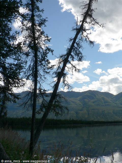
 Lake Creek - Yukon
|
Pagine 1
|


Alyeska: literally a "Great Land"... Trip to the Alaska state, United States
Località:
Anchorage, Turnagain Arm, Chugach State Park, Kenai Peninsula, Windy Point, Steward, Palmer, Talkeetna Mountain, Hatcher Pass, Willow, Trapper creek, Mt. McKinley, Denali Park, Wonder Lake, Mt. HealyRegione: Alaska
Stato: UNITED STATES (US)
Journey through Alaska with a 'just pop' in the Canadian Yukon
Text by Anna Marchisio (anna_mrcs@yahoo.it)
Photo by Marco Giovo - Anna Marchisio
"The Last Frontier," reads the license plates of cars. And in a sense it is! Alaska is a fascinating land, where the taste of the wild, the beautiful mountains, arctic and marine-ending glaciers which swarms. Alaska is a lot more than you can imagine and above is where the world with its traffic and its confusion, seems to belong to another galaxy!
As noted by Peter Jenkins "Alaska is a place full of surprises. Many things that I thought before I go there turned out to be the opposite of what I expected! "[P. Jenkins - Alaska. The country's gold and ice - 2003 Sperling & Kupfer Editori]
The literature abounds in books, novels and elsewhere, speaking of the extreme north of this corner of the world that fascinates and enchants from the pages of a book already before you even set foot, let alone once there!
Many of our friends have described the selection of this goal 'cold'. Similarly the decision to undertake this trip with the tent has been the subject of many objections: "But in Alaska always raining" "It's cold" "You can not go in a tent, it rains" are just some of the concerns we raised. But meanwhile, we stuck to our position: in Alaska in a tent! And that will never ... even if for the first time we use the tent in rainy places.
Rain rain .. I must say, but the experience of camping was part of this journey, this way of life this country. Otherwise would not be the same!
The camps, so to speak state, I can safely say that they are almost self managed. When you get your pitch you choose between free ones, you fill out the slip of paper and the envelope, taken at the entrance, you include the exact amount to be paid pretty well for you seal the envelope and the pockets are in a special box iron at the entrance. Voila .. recording is made, and payment as well! That remains is to mount the tent! In terms of services may be the only campsite with bathrooms (WC) and the water pump to those complete with hot showers (coin-operated by 25Cent). Many campsites are located in areas of particular beauty and surrounded by greenery and nature absolute. Every pitch then his table with benches el'immancabile space to make the fire in the evening. Rarely use it for making barbecue, use it at night to keep warm, almost more a ritual than a necessity.
At every camp, you can read the rules of conduct to avoid waking up the morning with a bear instead of her husband in the bag pela alongside. In some there are places here and there, metal containers where you can store food and whatever else might attract the attention of a bear. Precisely to avoid the bear to open these containers openings are always ingenious. No wonder then that I eat the tourists! If hiding the cookies!
In summer there are about 19 hours of light. We have spent a little to get used to this luxury, the idea of walking calmly as if they were 22 to 19 or do not have to use our batteries to light the night in tents.
Once again we were welcomed by ordinary people with extreme kindness and willingness to demonstrate that it is not fair to judge a people from their political or what the media served to us.
And for those who expect an America made up of McDonald's and company .. well .. Alaska is nothing like that.
GUIDE USED:
Alaska - 3rd edition 2006 - Lonely Planet - Ed in English
Western United States - 2nd Edition 2004 - EDT
Western Canada - 1st edition 1997 - EDT
Hiking in Alaska - 2nd Ed 2004 - AFalcon Guide - Morrison Book Publishing
REFERENCES
Ann Mariah Cook - My Alaska - 2001 Edition Piemme Pocket
Bob Drury - A season heroes - Corbaccio 2001;
Libby Riddles & Tim Jones - I won Alaska - 2003 Editions Piemme;
Lynn Schooler - Blue Bear - 2002 TEA;
Nicolas vanish - The little snow - 2003 TEA;
Peter Jenkins - Alaska. The country's gold and ice - 2003 Sperling & Kupfer Editori;
Richard Leo - Escape from Manhattan - 1998 EDT
Sam Keith - One Man's Wilderness - 2007 Alaska Northwest Books;
We land in
Anchorage on a Sunday afternoon with the sky covered with clouds. We chose
Anchorage as a place to start our trip because just as we say in Rome, that 'all roads lead to Rome', in Alaska it is said that 'all roads lead to
Anchorage'.
Entry Procedures are not the fastest. Among fingerprints, photographs, and various applications detailed audit of each page and each stamp in the passport the time passes and people are always in the queue. But in the end we are on the streets of
Anchorage with our car.
Anchorage is not the capital of Alaska as many believe. The capital is Juneau, located further south, in the part of Alaska to the west of British Columbia in Canada.
But
Anchorage is the largest city in the state, both in terms of extension and population. Born only in 1915 when the Alaska Railroad has based its headquarters in this area and due to its strategic position with respect to the means of communication: rail, road and sea, has set itself the beginning of the
Turnagain Arm and Knik Arm , knows a quick and faster growth.
The city in itself is nothing special, and his heart that knows far-west, with a scheme of all one-way, is pretty nice but nothing of that. Its location overlooking the ocean at the foot of the Chugach Mountains contributes instead to increase the charm of this place.
Natives or direct descendants of Native Americans are only 20% of the population of Alaska.
Anchorage is one of the most important cultural centers of Native American Alaska Native Heritage Center.
The natives belong to three main ethnic groups: Indians, Eskimos and Aleutians. Often the term of the Indians and natives suggest by the term Inuit Eskimos, but this is not so obvious and correct in Alaska. The Alaska Native Heritage Center provides a glimpse of what are these five people, with their cultures, traditions, languages, and especially with their history.
When talking of Alaska you can not fail to think of sled dogs, of course in winter! The Iditarod Trail Sled Dog Race is one of the most famous races in the world. Held every year in March from
Anchorage to None, covering a distance of about 1,750 km with an average walking time of two weeks. Throughout this time, if the musher must dig themselves with their dogs. Approximately one third of the competitors did not arrive at the end of the race. Not that all withdrawn if they are eaten by wolves road (the bears should be holed up somewhere in hibernation, make dreams quiet) but the difficulties of the race, and the extreme climatic conditions mean that this race can not be defined The attractive immense a quiet stroll north.
In 1985 for the first time the race was won by a woman, Libby Riddles [Libby Riddles & Tim Jones - I won Alaska - 2003 Editions Piemme].
On the origin of the name have been made more interpretation given to the different meanings that the word takes on Iditarod, or the word that probably result in several Indian languages: distant, far away.
As regards the origins of the race, the first was held in 1973 on the same path dell'Iditarod Trail. In 1925 a terrible epidemic of diphtheria struck the residents of Nome. It was winter, the weather conditions were such that it will ship the planes could carry the medicine that was available in
Anchorage. What to do? Were used dogs and sleds, thereby completing the shipment and contain the epidemic.
This episode has also inspired the cartoon Balto that, every year, systematically propina television at Christmas. Legend has it that Archie the dog leader of the expedition led by Leonhard Seppiala while in reality it seems that it were otherwise.
For those who are not always the musher's Iditarod Trail Invitational, a leisurely stroll aside each year to 50 people, on foot, by bike or on skis (!?!?!?!) walk the same path of the Iditarod Trail Sled Dog Race. What courage!
We leave
Anchorage in the direction of Bird Creek, where we spend the first night. For our first night in Alaska, we booked a room in a motel after a long trip by plane, about 11 hours and hesitation from the trip before, where the luggage has arrived three days later, we thought it was better to have a day margin, you never know ... just for luck!
The motel is chosen to Bird Creek, east of
Anchorage on Highway
Steward, one of the most scenic roads in Alaska.
The Stewart Highway is not only a panoramic, offering great views of
Turnagain Arm, the mountains of the
Chugach State Park, the glaciers of the Chugach National Forest and the
Kenai Peninsula but has particular points of interest such as Potter Marsh: where boardwalks allow a location to observe birds and salmon. The latter, in this season begin to climb the river to spawn. Or you can stop at Beluga Point and let one's gaze would intrude into the immensity of the waters of
Turnagain Arm in search of whales, or stop at
Windy Point, where he throws a good wind just like the name says, watching the goats Dall, and Dall Sheep licking salt present on the cliffs of the mountains that descend to the street.
Girwood, located 40 miles south of
Anchorage, is one of the largest ski resorts in the area, there are many ski lifts and large hotels within walking distance from the slopes and from those facilities. The town itself is small, the cross one day soon, and perhaps for now, perhaps for the slightly rainy weather, around you do not see anyone. At one point, a group of self-check, to our left, a black bear. Safely cross the street and we see it pass in front of our car to slip back between the houses and continue his journey. Bellissimo! Fantastic! Alaska has the highest concentration of bears, bears, blacks, browns and grizzlies and we came here hoping to see some too! There are also polar bears, but these must go much further north, but not this season.
We are headed to Seward, the
Kenai Peninsula. Along the way we meet the Alaska Wildlife Conservation Center, an entity that is dedicated to the conservation of wildlife in Alaska. There are bison musk oxen, moose on stage with velvet, deer, caribou, elk, coyotes, bears, blacks and grizzlies. A black bear sleeping on a tree while three grizzly cubs playing in a puddle of water.
We decided to start our journey from the
Kenai Peninsula, but the disastrous weather, heralding rain for much of the week, make us change our plans and decided to move towards the north, where the forecasts are a little less pessimistic. Bad weather in Alaska, particularly on the coast, is not something unusual or exceptional, so one must get used to and take it philosophically. Meanwhile, we go north, he, the time, do a little 'what I want!
Palmer lying about sixty miles north of
Anchorage is a rural town set in one of the few areas in Alaska devoted to agriculture.
Born during the presidency of Roosevelt to deal with the depression that had hit the rest of the nation. About 200 farm families moved into this area of Alaska giving rise to a thriving community of farmers who, even now, cultivate this land cover part of the agricultural products of the country. The landscapes, farmland, greenhouses and farms are typical of this area.
We stop for the night in a quiet campsite just outside the town. Find it is by no means easy in the city are under way with many road works on road closures for which to find an alternate route is not easy. It gives us a hand, a sheriff, now close to retirement, who kindly takes us to the campsite, because the explanation was simple.
The Matanuska River Camp is a quiet place. There are a few campers and a few tents. The area to the use of tents is nestled in the woods: they feel the birds sing, the squeak, if one can define, squirrels and many annoying mosquitoes.
The time has not yet settled but at least it does not rain and occasionally glimpsed in the heavenly sky. Leave the Highway, take the main road through the Talkeetna Mountains and we will all'
Hatcher Pass. This itinenerario is not crowded and often we stop to admire and photograph these beautiful mountain landscapes that are lost sight of an eye.
One of the main attractions of this area is the Independence Mine State Historical Park. Opened in 1930, was for many years the second gold mine in the area. The mine was closed permanently in 1955. Currently you can visit the mine and all that remains of the buildings of that era.
Continuing toward
Hatcher Pass, the road becomes a dirt road and transit is recommended only to cars. Along the road from the guardrail, they dull the head of the marmots. It seems almost impossible, with all the space they have available these cute mammals if they are on the road. Maybe they want a little 'company!
At the top of the hill welcomes us a strong wind and cold. The clouds in the sky runs like a dream. What to do? We prepare our backpacks and we start on a path that starts not far from the hill and seems to bring the tip of a mountain. Climbing meet small lakes. The landscape is very beautiful and pleasant walk. On top of some ground squirrel running between the rocks.
Returning to our car we go in the direction of
Willow. The road is all dirt and in some places is not quite perfect. Along the way we pause a moment to observe a pond with some developments that indicate the presence of beaver. And while I snap a few pictures a nice beaver makes its appearance in the lake. It was not alone! Beavers are usually nocturnal animals more day, but we see that the hole was in need of urgent repair, so the three beavers that we've seen busy in their job search and moving branches were unaware of our presence on the shores of Lake ! Fantastic!
We continue in the direction of Talkeetna, where we assumed to spend the night, but since the camp can not convince us we stop for dinner and then we resume our journey towards the Denali, the Alaska is a day late, so ...
Talkeetna, said the guide, is exactly the kind of country that people expect to see in Alaska. But what is the kind of country that people expect to see in Alaska?
The city, the village is perhaps best, is nothing of that. A dusty main street, because the roads are all dirt, a succession of shops and restaurants with a strong appearance at the time of the gold rush. The grocery store has an interior that recalls a bit 'of the store Oleson from' Little House on the Prairie '! The streets a swarm of tourists.
Talkeetna is the basis for all shipments on Mount McKinley, or language Athabasca: Denali, meaning "highest" in fact is the highest mountain in North America (6744 m). The Denali is a pyramid of rock, snow and ice very difficult to climb! Also in Talkeetna off the vast majority of airplanes every day with tourists tourists who can afford it, to the discovery of Denali National Park and of course the Alps since the approach is not done on foot, given the immense distances, but plane directly to the base camp.
The first shipment that 'won' the peak in 1913 was led by Archdeacon Hudson Stuck and a great explorer of Alaska. Every year in late spring, around 1000-1300 climbers trying to conquer the summit of Denali. If weather conditions are right about half of them will achieve the purpose and if the weather conditions are unfavorable, the percentage of those who reach the summit falls below 40% and some of them will die. What perspective!
In the cemetery, a memorial listing the names and ages of all climbers chasing a dream that died trying to climb Mount McKinley or the nearby spikes.
Just outside the village there should be a breathtaking view on Mount McKinley el'Alaska Range. You should ... because even today you can not really be a beautiful day of clear skies, indeed could be called a sad day for almost rain. We must also admit that more often than the summit of McKinley is covered by clouds or fog, so we should not be too many expectations on it.
Let Talkeetna and its people to resume the road to the north. Eventually we stop to sleep in a campsite, which is not a campground. A
Trapper creek is a service station with his small shop, a lawn with a few picnic table. While the tent I imagine the faces of our parents thought that sleeping on the lawn in front of the station, but basically what we are missing here? Nothing ... inside the service station there for up hot showers .. more than that ...
Although close to a Highway traffic is almost nonexistent, and the arrival of the dark seems to stop altogether. During the night I hear an animal, move out of the tent, I feel it eating grass, graze and from time to time travel. Should not be a bear, I say! In short, this is the second night we spent in a tent in Alaska and I have not yet used to the idea that the bears walk out as if nothing had happened. But now, I find myself thinking over these moments with great nostalgia.
We continue our journey north: to the Denali National Park. The sky is not yet completely clear the clouds come and go and there are high hopes of seeing the mountains of Alaska Range and above the summit of Mount McKinley. Along the way there are many vantage points, including two of these allow you to admire, even if from afar, the immensity of this mountain chain which forms a part. We stop for a long time in the first of these two points, but it was worth it because the clouds have lifted and the McKinley stood in all its majesty before us! Bellissimo!
Resume thus gratified, the way to the Denali National Park.
While the car runs faster on the road beside us spend unique landscape stretches of forests, rivers, lakes and mountains as far as the eye, a world that never ceases to fascinate and enchant.
Before arriving at Denali Nationl Park meets the Denali State Park which offers endless opportunities for trekking, canoeing, and explore a bit 'of this wild world enjoying splendid views over McKinley. We stop quite often we but time passes and our goal now awaits us.
The Denali National Park is a huge expanse of land with a central subarctic, as already mentioned, the highest mountain in North America: Mount McKinley. But not only the beautiful wild landscapes, and it must be said that there are villages within the park, to do great this park but also the countless species of animals living in it: marmots, moose, caribou, foxes, eagles sea white head (Bald Eagle), Dall Sheep, grizzly bears and blacks.
Every year more than 400,000 visitors go into this park and think that in 1922 he recorded no less than 7 visitors! In those years only the most daring and adventurous tourists could afford the courage to visit Denali National Park and Preserve,
In all this immensity there is only one road of 147 kilometers through the park. A little 'as saying a drop in the sea. The road, built between 1922 and 1938, it is not feasible with private cars. Actually there is a kind of lottery where the lucky winner of this lottery is authorized to travel this road with their car. Well one of these solutions a bit 'too American. For those who did not participate in the lottery, or who have participated but have not been extracted, you can take advantage of the many shuttle buses that travel this road every day.
At the entrance of Denali National Park we are in the midst of so many tourists and lots of confusion. Almost we are no longer used. Machines that seek parking, and tourists who wander through without looking, people who do not know where to go, in short people for all tastes. We are anxious to go straight to the Wilderness Access Center. Despite being advised to book anywhere in advance, both the overnight visit to the park, we have not done it one or the other. Manage to book the excursion by bus in the park for the next day and the tent is no problem, there are still a lot 'of vacancies in Camp Riley.
Mounted our tent on a pitch that we like in this huge camping, we go walk up to the park visitor center. It looks like a small town: there is camping, the store, the visitor center, a restaurant (but closes rather early in the evening ... mah ..), the railway station, some passes here and the Alaska Railroad, and even 's office. But in Alaska there are post offices even in remote areas, some in Italy should take a leaf instead of concentrating more on the town!
A system of trails connecting the various departments of the park thus avoiding tourists to walk along the paved road where the traffic is pretty intense.
After dinner we choose to return to the campsite via one of these paths, go before the Meadow View Trail where we meet some night suffered jogging, then end on the end of the Roadside Trail and take the McKinley Station Trail to return to the campsite. Walking with the silence and the peace of the evening along these paths is quite nice, sometimes a squirrel running fast from tree to tree. But the surprises are not over ... not far from camp we meet on the path, mother moose with her two children. We are pleased to observe, as if to decide which of us should give way ... but then mama moose decided to leave the trail to enter the woods followed by her children. The legs of children sometimes appear not to support them and remind those of a puppet, reindeer or Santa Claus.
The following day, with sufficient notice, we do find at the bus stop at 7.00. We actually see other people with whom to share this journey. There is an assortment of clothes from people and making people smile. There is up to the lady who brings a pillow from home and that most of the trip has been working on a kind of crochet or the one with the peaked cap borrowed from one casino in Las Vegas.
The bus leaves and the driver, a woman tells a little 'of the park. In theory this would be just a passenger, a kind of shuttle. The bus makes a series of stops, if you want you can go down and take the next bus, both on the way back. The problem is that the buses are always full and the place it has fixed only on what you have booked. Is not expected to travel by foot so the bus brings you only if there is room on board.
In any case, the bus will make some longer stays in some places and stops during the street, for sighting or photograph the animals. We would have preferred to visit the park to ourselves, but we have not participated in the lottery .. then ..
The day is not the best, indeed ... gets a bit cold and the sky is gray.
147 kilometers are many and constantly changing landscape, forest, tundra, grassland and glaciers. The McKinley is not visible everywhere from the park, but only a few points, having the main entrance of the news is not among them.
The Wonderl Lake, the end point of the bus, is so named because its waters are mirrored the McKinley, rare event, a little 'because the usual mists that hide the tip and a little' because time is never very employees! The bus stops just long enough for a stroll on the shores of the lake and get a snack for lunch, it's a shame the place deserves a visit in more depth.
If the weather is a bit 'spoiled the beauty of the landscapes that we have seen, as it were, contributed to by an animal point of view, only this trip. Not only foxes, caribou, eagles but eventually even some grizzly!
The Denali is one of the parks that has the largest number of grizzlies on its territory. Physically they are slightly less great than their relatives living on the coast, and this seems to be due to differences in diet. Those on the coast there are real eat salmon and other fish, while they mostly eat small mammals and plants.
But back to our first grizzly ... we have seen from a distance, the bus stopped, people took out cameras and binoculars. Gradually became less distant. Bush attracts his attention, it turns around, sticks his nose in there, rummaged with his paw and then starts to jump on. It is a huge grizzly bear, brown, the bush is crushed, a small ground squirrel terrified, literally splashes that bush to another. The bear sees him and follows him. Another bush, the same squirrel from Stan, the harsh law of nature. The bear is looking for him, rummages but the squirrel was once again faster, and without being seen as a missile escapes, running away from the bush. The grizzly does not notice, the tries but can not find it. Rummaged in the bush, stands up straight on two legs, we turn around, but his prey has escaped. In the end, disconsolate and resumed his way. Her legs, her nose, her move, her being a hunter, his world! Only for these moments for these moments is worth the trip so far.
Meet other grizzly, two puppies chasing a bear, and solitary walks.
The whole trip, round-trip takes about 11 hours, mostly spent on this bus that you can not really be comfortable considered then that the road is all dirt.
In addition to
Wonder Lake and a few stops' technical ', there are stops at Polychrome Overlook, where you can enjoy a beautiful view over the valley and mountains, if you have a little' luck you can see the Rocky Mountain goats graze on slopes of the mountains beyond the valley, and near the Tiklat River where there is a small visitor center with a little 'trophies and skins exposed.
And so another day has ended.
Today we wanted to go up Mt Healy Overlook Trail, but unfortunately, the information office of the park told us that the trail is closed due to some problems with a bear that is parked there. To our question whether there was another path similar to the ranger there said that there were no others, but we could have another peak and let us choose a path for themselves. I was a bit puzzled ... I can not follow a marked trail because there are problems with a bear, what makes him think that the path that I did not invent their own steps on the feet of another bear? For the moment we decide to abandon the intention to do so little explorers and resume our journey to the Yukon Canada.
The Denali Highway is a dirt road, 216 kilometers long linking Cantwell on the Parks Highway Junction to Paxson on the Richardson Highway. This would allow us to move from west to east in the midst of beautiful mountain ranges that offer spectacular panoramas of the Alaska Range, Talkeetna Mountains, and Wrangell Mountains. A booklet, distributed free at the entrance of the road describes points of interest.
The most spectacular part of the road, surely that is further east, the views sull'Alaska Range are unique, or because the weather in this area seems to be better, or because these wild landscapes enchant and fascinate us. Glaciers, Alaska Range, the plum tree, or West Fork, the peaks of McGinnis (3420 m) of Moffitt (3906 m) of Mount Hayes (4150 m) and others are immortalized by our cameras. And on days you can see really serene even the Wrangell Mountains.
Along this road we find very few cars, no motor homes, but this was expected, the dirt roads in Alaska are not food for friends, or better for wheels of these huge houses stray.
We stop for lunch in a picnic area, in perfect solitude, amid a huge expanse of green meadows with the wind and the blue of the sky remind me so much the Tuscan countryside.
There are paths and trails that leave from the main road, pity not know the area, shame not to have other information, perhaps in remote and fascinating places that carry these tracks. The charm of the wild, the remote also affects us.
What has always fascinated us and that never ceases to amaze us on this earth are all these open spaces, distant, vast and think that in a sense is unattainable, unapproachable. Feeling small in the face of such greatness.
About 25 km from Paxson takes you through an area called the Tangle Lakes Archaeological District. In this area found much evidence showing that more than 10,000 years ago this area was inhabited.
Once on the Richardson Highway take it north. For a long time, the huge snake pipeline keeps us company. This is the Trans-Alaska Pipeline Terminal, an oil pipeline that crosses the country from north to south from Prudhoe Bay to Valdez, carrying about one million barrels of crude per day, thereby covering 15% of the needs of the United States. It was built in 1975. Along the road there are even points of interest where a series of panels describing this example of modernity as if it were a monument. Well of course ... a monument to progress and the exploitation of earth resources.
Since 2001 he is considered a sensitive target for terrorism, in fact, until then it was possible to visit the end of this pipeline to Valdez, on that tragic date are no longer welcome visitors. In 1978 not far from Fairbanks someone with explosives, causing damage that took out dall'oleodotto about 670,000 gallons of crude oil. In 2001 a drunk with a rifle fired at him, causing the release of more oil.
At Valdez accident in 1989 caused a real ecological disaster. 11 million gallons of crude poured into the waters of Prince Willam Sound, damaging 2240 km of coastline, killing seabirds, sea lions, sea otters, sea eagles and millions of salmon and fish. A beautiful ecological disaster!
Our today's stage finishes in Delta Junction, where we find a supermarket that sells biscuits for breakfast, just like the ones sold in Italy! Hurray! We should no longer spread the jam on this subspecies of synthetic bread! The supermarket we stopped by a gentleman of East European origin. While she talks, has recognized our European origin. Tells us, in broken English almost like ours, which are years living in Alaska with his wife.
Delta Junction, like many other towns in Alaska and the Yukon shall close its 'birth', in early 1900, the gold rush.
23 bison were reintroduced in 1923 from Montana. The last bison, so to speak, indigenous, died about 500 years before. Currently there are about 500 animals in the area, which is why Delta Junction is also known as Buffalo Center.
Today we have a lot 'of road ahead. We will cross the border into Canada and get into the Yukon so moving the clock ahead one hour.
Immediately take the Alaska Highway, the only paved road that connects Alaska with Canada, from Delta Junction to Watson Lake: 2450 km of paved road. It was built in 1942 in just eight months in defiance of not only the difficulties of the time in creating a company like that, but especially the difficult climatic conditions of the place. Worked on thousands of American and Canadian military and even many natives. Unlike other streets in America, the Alaska Highway is not the usual straight. There has been much speculation about why there are so many curves, some say that the curves were used to prevent the Japanese pilots to use the road as a runway, after the Second World War was in progress, or those who claim that the tight timetable for the construction prevented the evaluation and selection of best routes.
The choice of name was not easy, now his name is Alaska Highway, but many remain Alcan, short for Alaska-Canadian Highway.
The road is not particularly busy, we had imagined a much more intense traffic. Meet some motorhomes, several trucks and some cars. The road is all paved even if the road surface is not the best and in some places because of work, some stretches are unpaved. These, unfortunately, are the effects of freezing and thawing and what is called permafrost, which is typical of these areas.
Crossing the border with Canada has not created any problem. A woman guard welcomes us in the Yukon, and wished us a pleasant journey.
From time to time we stop to admire some landscapes, photographing some lake, some animal, to enjoy these landscapes and this immensity.
For questions of our time visiting the Yukon will be limited to very little, just the Kluane National Park. But this vast region, about one third of Alaska big deserves to be known more in depth .. will be for another time. It is not only a barren Arctic tundra, as we used to think when you imagine the extreme north of this contienitene, but it is a land rich in mountains, forests and lots of wildlife. Together with the Northwest Territories, having both a low density of population in parliament do not have a full legitimacy as the others were Canadians. The region lives in addition to tourism, mainly due to the mines of gold, lead and zinc. The Klondaike with everything that has represented for the gold rush here is a reality. Not only for the architecture of some buildings but also for museums and what still remains as a reminder of an era long gone.
The capital of the Yukon and Whitehorse, but we do not visit.
Just out of curiosity in February takes place sleg Yukon Quest International Dog Race, another race sled dogs said to be one of the hardest and most challenging. Continue along for about 1,600 km in a fortnight on a path that leads from Whitehorse (Yukon) to Fairbanks (Alaska).
The road runs, for many, the huge Kluane Lake, the largest lake in the Yukon. To be honest, I expected not only much traffic on this road but also many more services, but is in perfect harmony with the rest of the two countries: miles and miles of nothing.
The first town we meet and Haines Junction, where we decide to stay the night. The small town is also an excellent base for exploring the nearby Kluane National Park, but the return visit.
With the construction of Alaska Highway, opened in 1942, so to speak, the modern history of Haines Junction, located along this road. In the years after 1942, was built the road along the Chilkat Pass allowing you to connect Haines (AK) to Haines Junction on what was known as the Dalton Trail that is a path that a certain Jack Dalton, in 1897, had drawn on the basis ancient Indian trails connecting Haines with deposits of gold in the Klondike.
Originally, before the construction of the road and then decreed that the official birth of Haines Junction, there was an Indian settlement known by the name of Dakwakada. A booklet, distributed free of charge, takes up a little 'history of the buildings in the city by suggesting an enjoyable journey on foot.
The next day we take the road to Haines. But once we make a first stop at Kathleen Lake. It is a glacial lake surrounded by mountains.
The highest point of the road is the Chilkat Pass, the landscape is almost strange that we have around, always changing and fast. The trees have given way to this extraordinary mountain scenery. The road is not busy at all, and more than once, along these major roads were almost deserted, we wondered where were the other tourists were where all the people described on guides and brochures. But all in all .. better that way .. As the road from the hill down towards Haines mountains are colored green trees and white glaciers, this is an area rich with glaciers and what can be seen along this road is a small part of what this area has to offer, enough to recall the not too distant Glacier National Park, a vast expanse of ice.
Moving toward Haines meets the Bald Eagle Preserve was founded in June 1982 with the aim of protecting the largest concentration of sea eagles white head (Bald Eagle) and the delicate ecosystem of their habitat. The reserve consists of about 48,000 acres of land around the rivers Chilklat, Kleheni and Tsirku. In this area there is the greatest concentration of eagles in particular during the late autumn and winter when there is a significant concentration of salmon. As is well known salmon begin in the summer to move up the rivers to lay the females, and fertile males, the eggs. Their race continues until the beginning of winter. After all this effort salmon die and thus become food for eagles. The combination of open spaces typical of this area and this store is that there is fish, to Haines, a high concentration of eagles that make this area unique. Between the 28th and the 33rd kilometer of the Haines Highway you can see this delicate environment.
Haines is a quiet town located at the bottom of one of the longest fjord in North America. It is a nice place, detail. Haines is surrounded by mountains and the sea, some of these mountains are covered with glaciers coming to get lost in the sea.
The former, apart from the native Tlingit, to settle in the area were a missionary couple, accompanied by a naturalist in 1879, thus starting the history of this country. In 1902 was inaugurated the first permanent military outpost in Alaska: "Fort William H.
Steward "where there is now a center of Indian art.
Before coming to Haines meets the junction to the nearby village of Klukwan. This place, full of charm and history, still has many memories of the past and keep alive the culture of the Indians.
After a quick tour of the city we go to see the area of Chilkoot Lake where there is also a campsite. In the center of Haines there are two camps, one for the motorhome and one for the curtains, but we used a bit 'too good to have our space and our quiet that this camp, a bit' too similar to ours, with people piled almost one on top, there has convinced at all. The area of Chilkoot Lake is crowded. The river leaves the lake is a succession of fishermen. I know as well that there are more salmon fishermen along the banks of this river. As we prepare to move back from the edge of the road appeared a brown bear, but then, disturbed by all the car, flees into the woods.
We choose instead the campsite of Chilkat State Park. It's a bit 'out of the way and for that strikes us. Completely surrounded by forests and woodland is a haven of peace and silence. There are very few people, it is to say that we get along a dirt road with a steep descent .. motorhomes if can not afford! The park overlooks the waters of the fjord, there are beautiful views of the fjord and the Davidson and Rainbow Glacier. Some warnings invited to pay special attention because some bears in the area running. Although I have already got used to this kind of view, the setting of the dark, when alone I had to walk a hundred meters to go to the bathroom .. Well ... at least sound closely. You never know ...
For the next day we had chosen the Mount Ripinsky, a beautiful walk that took us to a mountain peak overlooking Haines from which you could enjoy a magnificent view over the surrounding mountains, channels and would have even seen Skagway, so read driving. But upon awakening, we see that the clouds are low and most of Mount Ripinsky it is hidden in the mist. So fall back on Mount Riley Trail, a leisurely walk that takes us on the tip of Mount Riley, whose views from the top are still very beautiful. Certainly the tips of the mountains are hidden by fog, but overall the picture is not bad. For most of the time the trail leads through a dense forest. There are tall trees and plants that seem to come from a tropical forest with huge green leaves. Almost at the top, the landscape changes, the trees and the forest give way to low shrubs. Sitting on a rock we enjoy our lunch.
Before finally leaving this place we stop at the American Bald Eagle Foundation. We welcome the founder, a kindly gentleman who tells us a bit 'of this museum, a movie that cast and the many eagles that arrive in this area in winter. The movie is interesting, and allows us to discover that there is a center in Juneau for the recovery of these animals, shooting autumn Haines with millions of eagles make us envy those who, in the fall, will have the chance to see all these animals . Besides the movie, the museum is full of stuffed animals. Are arranged so as to form the beautiful scenes real, something unique.
Leaving the Bald Eagle Foundation will resume the road to Canada, our goal is again Haines Junction.
Along the way, almost near the Chilkat Pass encounter a fox running along the road. The outdated and we stop to photograph it, thinking that she would have diverted its route to the inside thus abandoning the edge of the road. Instead nothing, passes next to our car and it surpasses it. We move forward a little more 'and she again is beyond us. We go on like this for a while 'time, I'd be almost willing to say goodbye and leave, but Marco is curious to understand why he keeps running down the road despite our presence. Well .. while we were waiting for the umpteenth time exceeded our car, suddenly pounced on a poor hapless ground squirrel passing by. And that explains the mystery .. was looking snack! Often these small mammals are found along the way and despite the traffic is very little they can invest the same to get this guy instead of being invested has been caught by the fox.
After leaving the fox to its snack resume our way, but not for long. Not far away is a gyrfalcon feasting with one other poor ground squirrel. Black day for this species!
Is a sample of young gyrfalcon, its plumage is still partly brown with a few dash of white. It is a rare bird of prey. Once back home, Mark has contacted the Wildlife Service in Alaska to confirm the species of copy we have seen and photographed. He has very kindly answered a falconer who not only thanked us for reporting dell'avvistamento but it also provided some useful information and sent us a photo copy adult, a beautiful white-feathered bird of prey!
For the night we stop at the same camp Haines Junction, perhaps the only camp. A few more in the pitch of our Amish family on holiday with the caravan and a pikup. But these were not only gig?
Their clothes speak of another era. Clothes women blacks compared with blacks and reds my pants and my batteries seem to belong to different eras. The men then, with their beards and their trousers with suspenders blacks seem to me to come out of the set of "Witness to Witness". At night they were withdrawn early in their caravan in the morning but started to mess with their pots very soon.
The UN said the Kluane National Park founded in 1943, World Heritage. It is a huge wilderness area (about 22,000 sq km), partly inaccessible which along with neighboring Wrangell-St Elias National Park Alaska are one of the largest protected areas of the North American continent.
Inside the park you can see the non-polar ice fields of the largest in the world, dating back to the first ice age. But even if the park is mostly covered with ice, there are mountains, valleys, alpine lakes, forests and expanses of prairie and tundra, and lots and lots of wildlife. Elk, goats, Dall (Dall Sheep), goats, Rocky Mountain (mountain goat), bears, wolves, peregrine falcons, sea eagles are just some examples of wildlife that inhabits this vast park.
His name, Kluane, language Tutchone means 'many fish'. Today Native Tutchone try to keep alive their traditions and preserve their culture.
The mountains that make up this park and are visible along its border belong to the St Elias Mountains and Kluane Range and boast peaks with average elevation of 2500 meters. Inside lie the majestic peaks dell'Icefield Range, where towering Mount Logan (5950 m), the highest mountain in Canada and Mount St. Elias (5488 m), the second highest mountain in Canada.
We chose to walk the Sheep Creek Trail. The choice was not difficult, there was not much choice! There are some other trails are passable but in several days.
Let the Sheep Mountain Information Center from whose balcony you can watch the Dall Sheep grazing on the mountain opposite. Some telescopes made available to facilitate the view of the park of these animals.
The trail begins immediately well be to encourage the poor tourist! Beginning of the path is placed a beautiful plaque in memory of a hapless girl who died 11 years ago because of an encounter with a young grizzly bear. I do a quick account eh .. ops .. this bear might still be alive!
We walk along the path, we meet some squirrel, a few birds and fortunately no hungry grizzly. At first the trail passes through a dense forest and then come out in the valley offering fantastic views of the area and Kaskawulsh Glacier. At one point, as often happens with these paths Americans, the trail ends and you arrive at your destination. In this case we got on one of the many promontories in the midst of this valley. We may decide to continue and climb one of the nearby mountains but that would venture out from the path which you never know if they like good or not is made. Okay .. Meanwhile we are content for the trip, lunch, and we return to the car, after all we have before us many miles of road to Tok, Alaska again.
Is the first town you encounter after crossing the border into Canada, to 147 km from the border.
For dinner we choose a restaurant very lively and full of people, but the whole town seems more lively and full of other places.
Tok's story begins with the construction of the road in 1942, originally called Tokyo Camp, but the subsequent historical events and the feelings of some unfriendly people towards Japan transform the country name in Tok. Thus is explained the origin of this curious name that, in some ways, could deceive and remember a name of Indian origin.
The Wrangell-St Elias National Park and National Preserve with its 13 thousand acres of wild land with the adjoining Kluane National Park Yukon Canada form a large protected area where they stand rugged mountains, whose peaks are often well exceed the 4000 thousand meters in height , large expanses of ice, lakes, forests and large areas untouched. The park was established in 1980 and today, only two roads stretch into nell'infinto area of this park: one is the McCarthy Road and the other is Nabesna Road. Both dirt, both far from the real world, with its convenience and its hordes of tourists.
Although this park is extremely beautiful, like other parks in Alaska had few facilities and infrastructure for tourism is a real paradise for those who decide to visit. There are, in fact, the large numbers of tourists that may be found at Denali.
Along a piece of Nasbena Road. The road is 73 km long but in some places there are fords passable only with half off the road, in any case, the terminal part of the road, the Nasbena Gold Mine is located on private property. The road offers splendid views of the mountains and the vastness of these places.
Mount Wrangell, which is named after the park, is the largest active volcano in Alaska.
Leaving the Road Nasbena resume paved road in the direction of Valdez, shortly before arriving at Valdez Thomson cross the Pass. This road, not quite in the same way we now see, was opened in late summer and autumn of 1898, passing through the Keystone Canyon and Thompson Pass. The following year the military authorities adopted this path as a new military road to get to Eagle.
Valdez is a quiet town that overlooks the waters of Prince William Sound is located 40 kilometers east of the Columbia Glacier one of the most visited glaciers in Alaska, here also completed pipeline that crosses the country from north to south.
The history of Valdez is tied to the gold rush, was born in fact in those years around 4000 when gold seekers crossed the area directly in the Klondike. Before the arrival of the first explorers in 1778, these territories were the abode of the Chugach Eskimos, while in the north were the populations of the Ahtna. Both of these people used the area around Valdez for fishing, hunting and trading with copper and leather.
But the Valdez today is 6 miles to the east of the original installation, in 1964 a devastating earthquake razed the town to the ground, which was rebuilt exactly where he is today. This was one of the largest earthquakes, both in duration and intensity, which was recorded in North America. Not only Valdez was destroyed by this earthquake, but this also causes a significant tsunami was felt not only on the coasts of Alaska (
Anchorage included) but also on those of Canada to Washington State.
Valdez has a typical architecture from Far West, a marina with a pleasant walk in the wood that gives it a little bit of poetic and pleasant. The lovely scenery in which lies a pleasant stay in this city. Pity about the time that was not very cooperative.
I read in a brochure that you can visit an old cemetery used during the era of the gold rush (Trai l 1898 and 1917), the photos that accompanied the description intrigues me, so we decide to look for it. Are given on the brochure of instructions to achieve it, very detailed. Without this information there will never come because there is no sign and is achievable along a dirt road just outside of Valdez. Shortly before the cemetery there is a picnic area. The area has certainly seen better days and the cemetery was forgotten: there are weeds, as well as the picnic area. Too bad because they had taken a big driveway and a gate to enter. Everywhere, in trees, warnings recent information to be very careful of bears stationed in the area. While Marco photographer two sea eagles on a tree I take my camera and I set out to visit this place a little 'me uneasy. The fact is that I do not know if the suggestion or, indeed, while wandering through what remains of this stone, I hear noises in the dense forest and not the squirrels because they would not do so much noise. Since courage is not my job, to avoid unpleasant encounters with bears or ghosts are spun me and also very fast. Thus ended my exploration of this old cemetery.
We chose one of two private campsites in town, and it was a pleasant surprise, not because of the location and arrangement that reminds me a little 'too crowded but our campsites for people who have found and their great hospitality . We get that it is almost time for dinner. After the recording the lady at the reception asking us if we have with us the dishes. The question seems somewhat strange, but hastens to explain that they are doing a party in the campsite with fresh grilled salmon and other things we have prepared some ladies of the camp, but we must take his plate and cutlery. We are a bit 'displaced but the lady insists, does not leave us even go to the tent but it immediately sends to dinner. The fish was excellent, delicious, would venture to say the best we have eaten. Two guys clean the fish and cook the other two. There are many tables and other things to eat, like potato salad, pasta and snacks. We know a lady of the southern United States that has the patience and willingness to make conversation with us, because our English is not quite fluent. We thus discover that she and her husband, like many other couples of a certain age that we see around, not quite as it were on vacation. Once you reach retirement, they buy one of these microscopic motor home, close home and go around all year. Here a few weeks or months there and roam all over North America. What envy!
The Prince William Sound is an area of sea and about 3880 kilometers of coastline where there are fjords, islands and glaciers, including the famous Columbia Glacier. The waters of Prince William Sound are very deep and rich in flora and fauna: marine mammals, seabirds and fish.
Was named in 1778 by the famous explorer James Cook, who also passed this way! The world there are 429 statues in honor of this great explorer and one of them is also found in
Anchorage. Unfortunately he died a few years later in Hawaii, killed by the natives.
The best way to visit this area is the ship. We also have participated in one of those cruises that are organized in this area. Depart from Valdez to Seward or Whitter and all include a visit to Columbia Glacier. Besides the beautiful scenery the area offers, fjords, bays, islands and glaciers may encounter whales, orcas, sea lions, seals, sea otters and many seabirds such as cormorants, puffins and sea eagles inevitable. Unfortunately for us the day, from a meteorological point of view was not great but in terms of game but was really very useful. Sea otters have delighted us with their presence with their faces white and their float quietly at the back. Seals and sea lions lying on the first iceberg ice seconds on the rocks, enjoying the day. A bear that walks along a lonely beach, and yet the fin of a whale that quickly disappears into the water and the flight of puffins are just one example of what this tour has given us.
Once you leave the ship enters the Valdez Arm and Columbia Bay even though the Columbia Glacier is just around the corner its icebergs that float along the bay is starting to see from far away. A long trail of blocks of ice that comes out of the bay to go to get lost in the ocean. With the vessel to get close to the glacier and one is impressed dall'azzurro some icebergs. The Columbia Glacier, as unfortunately the vast majority of glaciers are there in this world, as a result of global warming is dramatically receding.
After leaving the Columbia Glacier Bay passes close to the Island to get into another bay and then be faced with Meares Glacier, an ice wall that occasionally drops blocks of ice into the sea. Near the glacier is quite cold, but some sea otters swim happily in its waters and nearby two rash kayak approach the glacier.
Lunch and dinner on the ship and return to Valdez in the evening. To greet the end of our cruise a male sea otter is dining in the harbor. Every now and then dives and succeeds with some mussels that with the help of the paws and teeth broken, why eat the inside and discarded the shell. Go forward a bit ', then finished dinner starts cleaning. We'll leave that relaxes floating calm waters of the harbor.
Unfortunately this evening the usual quiet of the camp was disturbed by three German tourists who, after having downed an unknown amount of bottles of wine and beer have not talked and screamed until he finally collapsed and went to sleep. But why capers people when out and about should always be recognized? However, both out of curiosity, it seems that there is a regulation prohibiting camping in the consumption of alcohol. Among other things along the roads we have often seen signs urging people not to drink before driving under any of these signs another sign that read 'In Memory of ....'. Apparently in Alaska that's a big problem .. but not only them.
We leave to head back toward Valdez Wrangell St. Elias National Park. Along the way we stop to photograph Horsetail Falls, the falls and winter freeze and make the happiness of ice-climber.
The Thompson Pass is completely immersed in fog and visibility is very poor, fortunately, a little later, near Worthington Glacier State Recreation Area, the situation is much better even if the day is very cold.
The Worthington Glacier is a glacier more easily accessible. Leave the car in the parking lot a short path leads to the base of it. The Worthington Glacier Ridge Trail starts from the parking lot and also along the entire glacier until you reach the icy expanse that overlooks the track. In some sections need to use a little 'attention because the path is pretty landslide but nothing of that.
Chitin is the last town encountered before taking the McCharthy Road, 149 km of dirt road passable only by off-road but not from ordinary cars, small vans, motorcycles or mountain bikes. The huge motorhome Americans traveling this road at some points is too narrow for the exaggerated size of these means.
Go to Kennicott and McCarthy is a little 'how to make a leap into a past not so far away, but in a world that has stopped.
Go along, almost completely alone in the McCarty Road, every so often you meet a few cars, you can see spectacular views of the Chugach Mountains, valleys and endless open spaces. The Kuskulana River Bridge, a suspension bridge over a dizzying whirlpool a taste of adventure to the trip. Although have secured his height and impressive.
The road ends at the bridge over the river McCarthy. The bridge is pedestrian only and the two towns are not reached by car. The current bridge was built in 1996 to replace a slow ferry system manual which was adopted as a result of yet another flood that destroyed the bridge over the river in 1981.
So all the cars are left aldiquà the bridge. On the other hand, a shuttle bus service, pay, connecting the two cities and the pedestrian bridge.
On this side of the bridge, to welcome you there are some parking areas, two campgrounds, the information office that provides several brochures on the area and a lodge and if it does not rain, so much dust! The first thought that crossed my mind we just got out was 'but where the hell we ended!'. Then, we found that viev Glacier Campground accepts credit cards and we could not help but smile at the thought that this world around us is clearly at odds with the world they belong to the credit cards. If we expect a campsite even resembling any of the ones we've seen so far, here is another music. The pitches, among boulders and bushes dry, are a bit 'left to the imagination of the campers. Shower or bath is something very original. But you can not help but bow to such great talent and ability to deal with what you have available. At the door, the only bathroom, there is even a lock but a sign, placed outside the door to turn when you enter and re-turn when exiting: Vacancy / No Vacancy! Inside, some pictures cut from old magazines try to make the small room less wilderness! What job guys! Never before in any other place the definition of 'The Last Frontier' sock with a brush like this!
Strolling through the streets of McCarthy is a bit 'as being part of an old photo-graphs. Some buildings have been renovated while maintaining its original features. So instead of the old McCarthy General Store hours are the seat of the Wrangell Mountain Center, an institution no-profict, which promotes environmental education programs for university students. The old Johnson Hotel still used to host and welcome the tourists in front of the McCarthy Lodge, or the adjacent Golden Saloon. And as the streets meet the old stores and even other buildings, more houses that are part of the history of this place. On street corners or in front of the houses, one can see objects at the time: old pickup trucks stopped for years, rusty wheelbarrows, garden tools, old wooden sledges and other items that bear witness to the glorious past of this place. Like the McCarthy-Kennecott Historical Museum, which with its objects, its old photographs traces the history of these places.
For dinner we stopped for a hamburger Mister Potato (Roadside Potatohead) a room a little 'special, where the kitchen is housed in an old wagon. The interior is divided a group of boys, with the owner or maybe just the clerk, a homemade chocolate cake.
But who are these two countries that have fascinated me so much and so they hit me?
Kennicott and McCarthy are two near-ghost towns that for years have been forgotten, hidden or protected from all this vastness of forests and mountains of distant lands.
Then when in 1974 the old railway track has been transformed in the street for cars, the two cities were plundered of everything that might be useful: windows, doors, etc. ... stripping the two cities of their effects and their memories. In 1998 the institutions of the Wrangell-St Elias National Park and National Preserve buy several buildings, including the mines, as part of a restoration project to preserve the history of this area of Alaska to mark the start of the slow restoration Shooting of this area. Many buildings still remain private property, in fact they now live permanently in the area, about 55 people.
The history of Kennicott and McCarthy began back in 1900 when Jack Smith and Clarence Warner, exploring the area, they saw a green spot on the mountain between the Kennicott Glacier and McCarthy Creek. Thus in 1906 was founded the first company to extract copper that would later be the Kennecott Copper Coorporation. The glacier and the city are known as one of the first explorers of Alaska: Robert Kennicott and the company, as a result of a misspelling, was called Kennecott!
To transport the copper extracted was built in 1908, a railroad that connected Kennicott in Cordoba: 313 km of track. Were built, not only the mines, offices and processing plants but the housing for the miners, engineers and their families, shops, schools and even a hospital.
Seven miles to the south but arises McCarthy. If Kennicott was the city where he lived and worked, McCarthy was one where it was going to have fun. They open restaurants, saloons, hotels, even two newspapers, a shop selling clothes, shoes, a hardware store, and that world is also the country's prostitutes made their appearance. All this led to rapid development in a short time, the number of people present in about 800.
But all this was going to die flourish in 1938 when the Corporation closed permanently Kennicott Copper Mine, in November, the last train, which gave a now discontinued service, he left for the last time, bringing with it the last inhabitants of Kennicott and McCarthy. This is the glorious past of these places!
We wake up in absolute silence during the night is raining, and although the next day is not the best, Kennicott waiting only to be discovered and explored. Took a bus shuttle, which has seen better times, we begin a fascinating journey into the town red and white. While McCarthy remains hidden among the thick vegetation, Kennicott you begin to see from far away, located along the mountain not far from the language of the Root Glacier. The whole city is a collection of buildings and constructions other than strictly between them but all colored in red and white.
Kennicott arrived to wander a bit 'for the city alone and we head towards the starting point of the Root Glacier Trail that runs along its namesake glacier.
The visitor center of Wrangell-St. Elias National Park and Preserve is located in what was the filing of the railway. Every corner of this country, of this city tells the story of what happened. Much has yet to be restored, something has been lost forever, destroyed by time. But the charm that this place holds on people and their curiosity is a lot ... but you have to give a little 'attention, when you study close to buildings because it could be dangerous. And we should always remember that some houses are private property, whose owners might not like to be curious people who walk in the garden or peeking out the window!
The Root Glacier Trail (5.6 kilometers one way) is a nice path along the glacier, you can take a peek at its base and then resume his journey. And as we walk in the thick vegetation we find a quiet black bear, near the path, you are berry strafogando! Most probably, indeed certainly, we heard there because when we spot him he was just looking in our direction. For a few seconds we observe, we look at him and he looks at us. We are delighted and he'll be thinking 'here MMIII scassa ... of two other tourists, one can no longer even have breakfast in peace'. Eventually resumed what he was doing: eating and we resume our way.
Back in one of Kennicott resume shuttle bus and from there our car towards Glennallen. If last night to keep us company at the campsite there were few other tourists this evening camp is nearly full and the restaurant we chose for dinner was a bustle of people and groups of tourists.
Glennallen is located at the junction with the Richardson Highway and Glenn Highway, which will travel tomorrow, just for this position is often called 'the hub'.
Before the gold rush, the discovery of copper mines in a large area of Alaska was inhabited by the Ahtna Athabascan Indians. In 1971 the United States government, with the Alaska Native Claims Settlement Act gives full legal title to these people on a territory of 1.7 million acres in an area that stretches from Cantwell to chitin. This area is now governed dall'Ahtna Incorporated with the aim of preserving this land and pass on the culture of these peoples for future generations. These lands are private therefore can not be accessed unless you purchase a regular permit. This is called business sense!
Driving along the Glenn Highway, where the road works are underway which require a long stretch of the one-way alternating during the day and closing the road from midnight to six in the morning, roughly 162 kilometers to the one can observe the Matanuska Glacier . This is one of the most easily accessible glaciers in Alaska: the praticamene before you arrive by car. From the road you can make good photos of the tongue of the glacier that burrows into Chugach Mountain.
At kilometer 168 you can see the Sheep Mountain, whose rocky slopes take on different shades of red. The Glenn Highway has recently been called National Scenic Byway, runs in fact a beautiful Valley (Matanuska Valley) surrounded by beautiful mountains and glaciers
And today we decided to dedicate to the exploration of the wilderness just as we had been advised time ago by a ranger of Denali National Park. Choosing a destination, backpacker we walk. We say that almost immediately the choice has not been very sensible. For some traits we follow the paths of quod, for other traces left by animals because the shrubs are too tall and impenetrable. Who said it was easy? Then .. finally we leave all this vegetation and you can walk to stroll to the world. It was an experience too!
For the night we stopped again to
Palmer, the usual camping usual pitch, but this time we find it without the help of the sheriff.
The
Chugach State Park with its 500,000 acres in extent is the largest park in North America with an internal settlement urban
Anchorage.
Today's program includes a hike: the East Twin Pass Trail. The trail starts from Eklutna Lake in the valley located at the heart of the Chugach Mountains. It 'a beautiful place to spend a pleasant day in an environment that sometimes recalls our alpine valleys.
We leave our car in the parking lot and backpacks on the path will take us up a hill from which one can enjoy a beautiful view of the entire valley and beyond.
First follow the Twin Peaks Trail originally a dirt road and then a wide path, after you take the East Twin Pass Trail a real mountain path. The first leg down to ford the river after which it begins to rise between shrubs and grass and then, give way to the tundra, in the latter part the trail is just more of a track but the hill is just above us so do not can be more wrong road. The trail winds along 6.4 kilometers, one way for an actual height difference of about 1100 meters.
Scattered over the prairies there are lots of Dall sheep (or the Sheep), almost all females with their cubs. The males, are seen in the distance, with binoculars, under the slopes of Mount Peak. Going up we meet a couple, uncle and nephew. With Uncle exchange a few words on the top of the hill watching the grandson, all alone, climb to the summit of Mount Peak. Cavolaccio and physically and I want!
Blows on the hill a bit 'of wind but the view is magnificent, the day is beautiful and we can enjoy the beauty of these places.
The
Kenai Peninsula is a peninsula big as Belgium, rich in fauna and also to tourists because it is easily accessible. Its coasts are rich in marine life while in the mountains and forests are home to bears, moose, Dall goats, mountain goat and others. Cities such as Seward, Homer, Soldotna, Kenay City, the famous Kenai Fjords National Park or the lesser known Kenai National Wildlife Refuge is an example of what can be found in this vast area. From the point of view of tourism the area has much to offer and also show the mountains of tourists and fishermen who flock to these areas.
There's no trip to Alaska that included a stop, albeit short, Seward: good base for exploring this beautiful corner of the
Kenai Peninsula is the Kenai Fjords National Park, one of the most visited national parks of Alaska.
Seward, situated in the Resurrection Bay at the foot of Mount Marathon is not only one of the oldest towns in Alaska but is also one of the most easily accessible. It was officially founded in 1903 in the same site of an abandoned native village. Bears the name of Willam Henry Seward, who was Secretary of State under President Lincoln and was one who planned, in 1867, the purchase of Alaska from Russia.
The Seward Highway, quite rightly considered a very scenic road, you can reach Seward from
Anchorage in just under four hours
In summer, the picturesque streets of the city come alive with tourists, camps and hotels sold out, the shops are a succession of people entering and leaving, as well as art galleries in the city and the many restaurants that serve not only salmon but also other delicious fish from the seas of Alaska.
The Alaska Sealife Center, located in the city, with its aquarium, its tanks, fish and sea birds is just the beginning of what this area and this park offer in terms of wildlife.
The Kenai Fjords National Park was established in 1980 with the intention to protect and safeguard the enormous Harding Icefield with its enormous glaciers whose languages are lost in the ocean, and the precious and delicate ecosystem present in these fjords. Of its 607,805 acres that make up the park, most are impenetrable and help fuel the fascination of this wild land. More than half of this territory is covered dall'Harding Icefield, which takes the name of President Warren G. Harding, who visited Seward in 1923. The Harding Icefield is what remains of the last glaciation, is a valuable record of how the continent was to be when it was completely covered with ice.
The Kenai Fjords National Park is not only the Harding Icefield, but also an environment of rainforest where there is a wide variety of wildlife. For years, Native Americans lived on these lands, hunting and fishing along the fjords. Traces of this past are visible through the few archaeological sites relating to Native Americans and what remains of the gold mines of the past. The first to colonize the area were the Russians.
The majority of tourists arriving in Seward, we are intending to take part in one of the many cruises offered by many companies operating in the city. And so we did too.
The cruise we chose us to plan the navigation in Resurrection Bay, visit all'Aialik Glacier and a stop at Fox Island for a dinner of grilled salmon. We chose to make another trip of this kind is for wildlife and for its landscape. The day was fruitful and interesting, we saw sea eagles, a few sea otter, lots of fur seals, sea lions, puffins, cormorants and 3 nice killer whales, one male and two females, who have much and then swam in a bay pass under the boat and take the offshore offering aimed emotions. We have even been some Rocky Mountain goat with her mantle white as snow quietly grazing on the slopes of these mountains that fall above the sea.
The glaciers are always a thrill, these huge tongues of ice that are lost in the sea, the icebergs floating in calm waters of the bay.
But the sea does not only meet cruise boats, but also and above all more or less small vessels and boats of fishermen. This summer, remember, is the season when the salmon leave the sea to go back to the river to breed, and is also the season when myriad of fishermen flock along rivers to fish this fish where bears I'm very greedy!
But fishing is not only and exclusively Salmon Fishing season the halibut fishery is the Fish Rock, a huge red fish with an eye appealing, and many others. There are even contests and fishing tournaments, including the most famous events in the Jackpot Halibut Tournament, to be held in June, awarding a cash prize all'Halibut bigger (and heavier) and the Seward Silver Salmon Derby held in August for the salmon fishing dell'appunto 'silver' which attracts fishermen from around the world.
The following day will be dedicated to one of the most beautiful trails in Alaska: Harding Icefield Trail, the trail runs along some stretches language dell'Exit Glacier, offering several excellent vantage points on the glacier and the valley.
The Exit Glacier is another more easily accessible glacier in Alaska and this is also one of the most popular and visited. From Seward is more or less fifteen kilometers of paved road. Some trails allow easy to approach the base of the tongue of the glacier to admire its grandeur, its color. Some of these routes are accessible by wheelchair.
In less than three hours driving around six miles and half a drop in altitude of just over 900 meters before we arrive to a small part dell'Harding Icefield: this enormous expanse of ice that dazzles and overwhelms in its immensity. If we turn our gaze on the rocky peaks that overlook the sea ice could see the mountain goats graze peacefully.
Not a difficult path but requires a little 'training and a little' experience in the mountains, especially the last part, where the ground is crumbling. But eat your picnic lunch, sitting on a boulder, facing the vastness dell'Harding Icefield, amply repays the effort.
A blackboard placed in front of the Exit Glacier visitor center, reports sightings of bears and mountain goats along the paths. It is quite common for hikers traveling the Harding Icefield Trail, in the first part of the route, where the vegetation is thick and abundant, the bears encounter blacks. We met mother bear and her cub and just off a copy solitaire! But remember that even if they seem adorable plush life-size, it is best observed from a distance and not disturb!
The Kenai National Wildlife Refuge borders the Kenai Fjords National Park and covers a vast amount of land within the
Kenai Peninsula. The Kenai National Wildlife Refuge was established in 1981 to protect the moose by the name of Kenai National Moose Range. In 1980 his name was transformed in the name with the aim of protecting not only wildlife but also throughout the sensitive habitats on which they live. The area is rich in lakes and rivers, fishing is abundant and even trekking paths are many. 'll Be spoiled for choice.
For the night we stop at a campsite in Soldotna along the Kenai River. There are plenty of fishermen who are fishing with what is known here as the technique of 'The Soldotna Flip' a kind of fly fishing, for those who know what it is.
The name of the city seems to have two origins, from the Russian word to describe the word 'soldier' or the word in the language of the Indian Kenaitze meant 'river'.
It is a city with its traffic and its buildings, for us a place of passage.
The visitor center is provided and there are also stuffed fish, I read that in Soldotna has been harvested the largest king salmon ever caught.
In this area the signs of the Russian transition are evident.
The next day we take a detour on the Kenai Beach, the day is calm and you can enjoy a good show in the mountains of Alaska Range that are just across the channel.
The Portage Valley is located within the Chugach National Forest, roughly 50 miles from
Anchorage along the road to Whittier, along the Seward Highway in this direction, one can not but be fascinated by the sight of these mountains and the many glaciers.
Portage Glacier overlooking the waters of Lake Bled. The lake did not exist until a hundred years ago, the tongue of the glacier reached up to where now stands the visitor center. From the Portage Glacier visitor center is not visible, you can choose to take a boat trip to the base of the same or you can walk down the Portage Pass Trail that leads with a short walk, on a promontory facing the glacier, solution that we choose.
We mount our tent Williwaw Campground, and if we raise our eyes in the trees rises the Middle Glacier, in short, for $ 13 we have an accommodation with views of the glacier. The campsite is really nice, one of the best we stayed.
After dinner we just pop up at Fish Viewing Platform to observe the salmon, there's also a nice path that runs along a river. A pleasant walk before going to bed in silence and peace that these places can give.
In the morning, a cute little rabbit runs away from our tent.
The Chugach National Forest was established in 1907 and covers about 5 million acres covering a wide area of the Chugach Mountains,
Kenai Peninsula and the vast lands that border the Prince William Sound. Inside the reserve you can hunt and fish, of course there are appropriate rules and permits to be requested and respected.
We are headed to the end of Crow Creek Road, a road that begins just before the center of Girwood where we leave our car and continue on foot along the Crow Pass Trail.
Along the Crow Creek Road meets the junction to Crow Creek Mine, a historic site, built in 1898 as a base for the nearby mine that between 1898 and 1940 produced about 700 ounces of gold per month. A place where time seems to stand still, even today there is no running water, electricity and telephone.
Today we are not alone to tread this path. There are several cars in the parking lot and many people who are preparing for the trip. The trail initially passes into the dense vegetation, there are blackberries and blueberries growing along the trail, and eat, but then I come some guilt, maybe some bears are a good snack if I eat, I eat him? Me. so it's better that I leave the blueberries and blackberries where they are.
The trail winds along a distance of 6 km for a height difference of about 600 meters. Meet the waterfalls, glacial lakes, remnants of old abandoned mines and if we look around peaks and many glaciers. From the top of the hill overlooking the valley leading down to Eagle River and you can admire the Raven Glacier in all its beauty. A handsome male mountain goat (goat Rocky Mountain) peaceful pastures across the glacier. Going down near Crystal Lake meet a female mountain goat with her baby.
Early in the morning the ground squirrel are already active. At first light of dawn began to run and deliver them to. One in particular, seems fairly close to the tent, and even if it is a great way to be woken up to us asking if they could not go messing around in another direction.
Dismantled our tent we are moving towards the Anton Memorial Tunnel. The day's program includes a walk to Portage Pass to admire the namesake glacier and a visit to Whittier, which I read many opinions and intrigued me.
Whittier was born during the Second World War as a port and a railway tunnel was dug in order to connect the port to the rest of the country. Only in 2000 the gallery opened to automobile traffic. The local population has for years been opposed to this project. In summer the trains arrive regularly every day while in winter remained isolated for long. But there were only meet the economic, by oil companies which financed part of the conversion of railway tunnel in the tunnel for the cars to ensure that the project is done but also the cruise ship companies and the prospect of booming tourism sector. As a result, unless and until the people did not want to get out of Whittier, preferring the isolation, once built the tunnel for cars, most of them moved elsewhere accordingly now many people working in Whittier no longer live here.
The Anton Memorial Tunnel is 3.5 km long and crosses the Chugach Mountains. Works one-way-time. At a certain hour traffic proceeding in one direction to another in the opposite direction to pass yet another hour rail traffic.
Whittier is at the end of Anton Memorial Tunnel and overlooking the waters of Prince William Sound. What do I say? The guide says, ironically, we might have seen glaciers, fabulous people, the highest mountains in the world but also looking everywhere we've never seen a place like Whittier ... than he's wrong!
I was expecting a place like Seward or other I'd seen before but it's nothing of this. Whittier, embraced by mountains and waters of Prince William Sound in itself would have all the elements to be a fascinating and beautiful city, but the ugly buildings dating back to World War II and an ugly concrete building not only scar the landscape but ruin the whole of this strange place. The port souvenir shops, restaurants and various offices of the companies that organize trips in Prince William Sound., Up to a fence with two reindeer. And if the companies that Valdez fjord cruises they were few here are many, you'll be spoiled for choice.
The beginning of the Portage Pass Trail is located just past the tunnel immediately in the direction of Whittier. The path 3.2 kilometers (A / R) is a pleasant walk that leads to tip in a particular tip exactly opposite the Portage Glacier.
Today is a beautiful day, there's a cloud in the sky and the sun is very hot, perhaps too much. There are no half-measures?
We walk quickly, with our car on the O'Malley Road in
Anchorage, a road leading out of town in a residential area where I can see real ville! If I were to live in
Anchorage I live in one of these beautiful homes with these fabulous gardens.
We leave our car in an empty parking lot and we walk on a dirt road. The path we have chosen is the Wolverine Peak Trail that will lead us as the name on the top of Wolverine Peak one of the highest mountains overlooking
Anchorage.
The trail is initially a kind of forest trail that passes through a dense forest, slowly begins to rise and vegetation to reduce and eventually disappear altogether. The path is long and too far uphill. Going up, looking back we see in the dense vegetation, a bull moose that walks. Almost at the top we meet a kind gentleman of
Anchorage, the very practical place, which shows us the names of all the most significant mountains are seen on the horizon, including the right to McKinley that he called Denali .. Oh yes ... even though it is hundreds of miles away you can see perfectly and the day today, not as calm as there were other, even allows us to see the much-coveted points.
The view from Wolverine Peak is fantastic not only
Anchorage but we see valleys and infinite space. The whole effort was amply rewarded. The Wolverine Peak Trail winds along a path 8.8 kilometers one way for a height difference of about 1080 meters. The return was very difficult, because the day has been really hot. Coming down we met along the way, many people who were jogging. I read that the residents of
Anchorage are fixed with jogging and physical activity in general, and often stop for lunch instead of burgers and fries strafogarsi go to the gym or doing some other physical activity.
And so came the last day of this trip. Our plane leaves early in the afternoon, we still have a morning to devote to this country, or at least what remains of this morning as the preparation of the luggage has not been an easy and fast.
We walk along the Eagle River Road, a road that follows the Eagle River penetrating the Chugach Mountains to the Eagle River Visitor Center. We would like to take the Albert Loop Trail, but as so often this season the trail is closed to allow the bears to fish quietly salmon on the River. So we are content to go up to Beaver Dam, which the beaver preserves only the name and to enjoy, even if still briefly, of this immense landscape.
Language Eskimo word Alyeska, hence the current name of the 49th state of the United States, meaning 'Great Land' el'Alaska is really a great land! This is not only been a holiday, a trip, but an experience and the discovery of a place to go.